Charles V Wall, Gibraltar
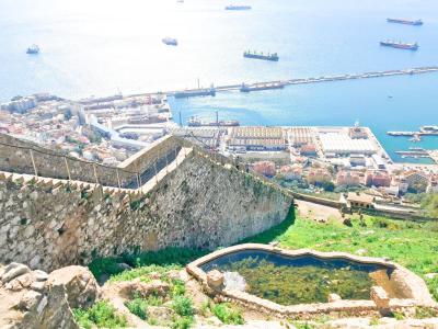
The Charles V Wall, originally known as the St. Benedict's Wall (Muralla de San Benito), is a 16th-century defensive barrier forming part of Gibraltar's fortifications. Constructed in 1540 and fortified in 1552 by Holy Roman Emperor Charles V, this wall remains mostly intact. It stretches from the South Bastion, which once stood at the water's edge in the harbor, all the way to the highest point of the Rock of Gibraltar.
During its construction, the primary concern was the threat posed by Barbary pirates to the city. In September 1540, Gibraltar endured an attack by corsairs led by Piali Hamet, a captain under Barbarossa. The town was looted, and prominent citizens were taken captive. The Muralla de San Benito, later known as the Charles V Wall, was erected in 1540 to protect The Rock against future assaults from the south.
The lower segment of the wall ascends from the South Bastion, formerly located at the harbor's shoreline, up to Prince Edward's Gate at the base of a steep cliff. It features the Puerta de África (Gate of Africa), which is guarded from above by the Flat Bastion.
Recently, the upper portion of the Charles V Wall underwent restoration efforts by the Bonita Trust in collaboration with the Government of Gibraltar. Currently, the wall is well-preserved, equipped with a handrail, and allows visitors to walk along its entirety, from the base to the summit of The Rock.
Want to visit this sight? Check out these Self-Guided Walking Tours in Gibraltar. Alternatively, you can download the mobile app "GPSmyCity: Walks in 1K+ Cities" from Apple App Store or Google Play Store. The app turns your mobile device to a personal tour guide and it works offline, so no data plan is needed when traveling abroad.
Charles V Wall on Map
Sight Name: Charles V Wall
Sight Location: Gibraltar, Gibraltar (See walking tours in Gibraltar)
Sight Type: Attraction/Landmark
Guide(s) Containing This Sight:
Sight Location: Gibraltar, Gibraltar (See walking tours in Gibraltar)
Sight Type: Attraction/Landmark
Guide(s) Containing This Sight:
Walking Tours in Gibraltar, Gibraltar
Create Your Own Walk in Gibraltar
Creating your own self-guided walk in Gibraltar is easy and fun. Choose the city attractions that you want to see and a walk route map will be created just for you. You can even set your hotel as the start point of the walk.
Rock of Gibraltar Walking Tour
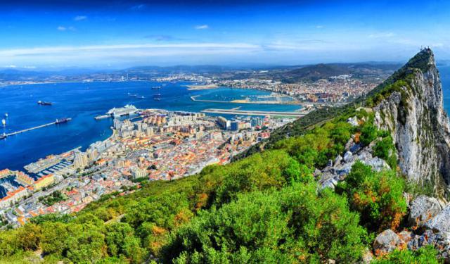
You really can’t avoid the Rock of Gibraltar when visiting the British Overseas Territory on the southern tip of the Iberian Peninsula. Just like the streets lined with British-style red phone booths and historical buildings, this prominent limestone rock formation, overlooking the Strait of Gibraltar from an elevation of 426 meters (1,398 feet) above sea level, creates a distinctive atmosphere... view more
Tour Duration: 2 Hour(s)
Travel Distance: 4.5 Km or 2.8 Miles
Tour Duration: 2 Hour(s)
Travel Distance: 4.5 Km or 2.8 Miles
Gibraltar Introduction Walking Tour
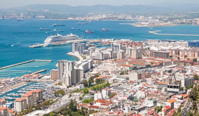
“Burn your boats,” ordered the Berber commander Tariq ibn Ziyad as his troops trembled before the towering Rock of Gibraltar in 711 AD. Having just crossed from North Africa with a small army to confront the Visigothic Kingdom, Tariq destroyed his ships to eliminate the option of retreat. With no way back, his men fought with determination and went on to conquer most of the Iberian Peninsula.... view more
Tour Duration: 1 Hour(s)
Travel Distance: 1.9 Km or 1.2 Miles
Tour Duration: 1 Hour(s)
Travel Distance: 1.9 Km or 1.2 Miles


