

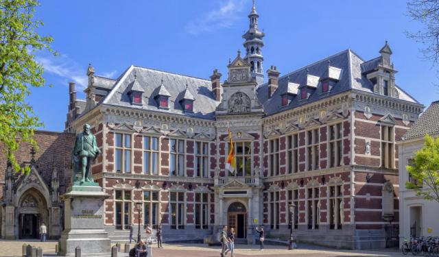
Stadhuis van Utrecht (Utrecht City Hall), Utrecht
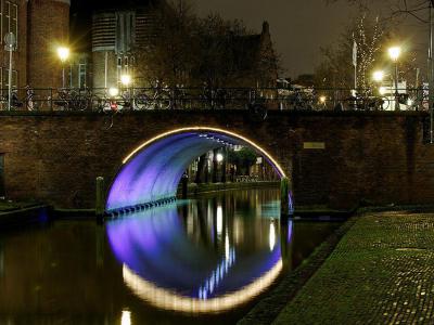
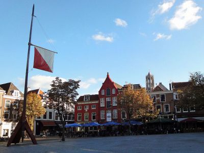
Utrecht City Hall, located on the Town Hall Bridge spanning the Oudegracht, is a complex of buildings that have undergone centuries of transformation. Its current form reflects a blend of medieval, Renaissance, neoclassical, and contemporary architectural influences.
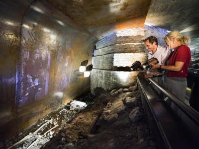
The story of Utrecht City Hall begins in 1343 when the city's aldermen were forced to vacate their previous meeting place in the trading district of Stathe due to the expansion of the Buurkerk. They relocated to the Hasenberg building on the Oudegracht, at the site of the current town hall. In 1537, the city council moved into the twelfth-century Lichtenberg house next to Hasenberg, which still retains its original wharf cellar.
Between 1537 and 1547, under Emperor Charles V, the city council merged the Hasenberg and Lichtenberg buildings, adding a Renaissance façade to Hasenberg while Lichtenberg retained its medieval look. In 1547, the Huidenbrug and Broodbrug bridges were consolidated into the Town Hall Bridge. A bell tower with a carillon by Jacob van Eyck was added to Hasenberg in 1582. Later expansions included converting Keyserrijk into a weighhouse in 1614 and unifying structures on the Oudkerkhof with a classical side wall in 1643.
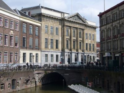
In 1826, architect Johannes van Embden replaced Hasenberg and Lichtenberg with a neoclassical building, completed in 1830 with a Bentheimer sandstone façade and four Doric columns. In 1957, Pieter d'Hont added a pediment sculpture symbolizing municipal functions. Expansions continued, including a uniform façade along the Oudegracht in 1934 and a Civil Affairs building by Johannes Izak Planjer in 1935.
In 1997, architect Enric Miralles was commissioned to renovate Utrecht City Hall, demolishing much of the Civil Affairs building and altering the neoclassical structure while preserving its outer walls and reception hall. The entrance moved to Korte Minrebroederstraat, and Queen Beatrix inaugurated the revamped hall on August 30, 2000. Today, the city hall reflects Utrecht’s evolving architectural history while remaining its administrative center.
The story of Utrecht City Hall begins in 1343 when the city's aldermen were forced to vacate their previous meeting place in the trading district of Stathe due to the expansion of the Buurkerk. They relocated to the Hasenberg building on the Oudegracht, at the site of the current town hall. In 1537, the city council moved into the twelfth-century Lichtenberg house next to Hasenberg, which still retains its original wharf cellar.
Between 1537 and 1547, under Emperor Charles V, the city council merged the Hasenberg and Lichtenberg buildings, adding a Renaissance façade to Hasenberg while Lichtenberg retained its medieval look. In 1547, the Huidenbrug and Broodbrug bridges were consolidated into the Town Hall Bridge. A bell tower with a carillon by Jacob van Eyck was added to Hasenberg in 1582. Later expansions included converting Keyserrijk into a weighhouse in 1614 and unifying structures on the Oudkerkhof with a classical side wall in 1643.
In 1826, architect Johannes van Embden replaced Hasenberg and Lichtenberg with a neoclassical building, completed in 1830 with a Bentheimer sandstone façade and four Doric columns. In 1957, Pieter d'Hont added a pediment sculpture symbolizing municipal functions. Expansions continued, including a uniform façade along the Oudegracht in 1934 and a Civil Affairs building by Johannes Izak Planjer in 1935.
In 1997, architect Enric Miralles was commissioned to renovate Utrecht City Hall, demolishing much of the Civil Affairs building and altering the neoclassical structure while preserving its outer walls and reception hall. The entrance moved to Korte Minrebroederstraat, and Queen Beatrix inaugurated the revamped hall on August 30, 2000. Today, the city hall reflects Utrecht’s evolving architectural history while remaining its administrative center.
Want to visit this sight? Check out these Self-Guided Walking Tours in Utrecht. Alternatively, you can download the mobile app "GPSmyCity: Walks in 1K+ Cities" from Apple App Store or Google Play Store. The app turns your mobile device to a personal tour guide and it works offline, so no data plan is needed when traveling abroad.
Download The GPSmyCity App
Stadhuis van Utrecht (Utrecht City Hall) on Map
Sight Name: Stadhuis van Utrecht (Utrecht City Hall)
Sight Location: Utrecht, Netherlands (See walking tours in Utrecht)
Sight Type: Attraction/Landmark
Sight Location: Utrecht, Netherlands (See walking tours in Utrecht)
Sight Type: Attraction/Landmark
Nearby Sights

Walking Tours in Utrecht, Netherlands

Create Your Own Walk in Utrecht
Creating your own self-guided walk in Utrecht is easy and fun. Choose the city attractions that you want to see and a walk route map will be created just for you. You can even set your hotel as the start point of the walk.
Utrecht Introduction Walking Tour
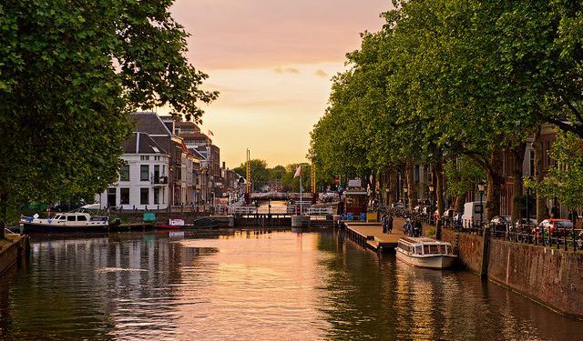
The earliest settlers to the area now called Utrecht likely arrived millennia ago during the Stone Age. While there are also signs of inhabitation during the Bronze Age, scholars today credit the Romans with building what became the town.
They set up a castellum around the year 50 AD, a fort right at a crossing point on the river Rhine. The fortress marked Rome's northernmost point in... view more
Tour Duration: 1 Hour(s)
Travel Distance: 1.6 Km or 1 Miles
They set up a castellum around the year 50 AD, a fort right at a crossing point on the river Rhine. The fortress marked Rome's northernmost point in... view more
Tour Duration: 1 Hour(s)
Travel Distance: 1.6 Km or 1 Miles
Utrecht's Historical Buildings Walking Tour
Originally founded by the Romans, and once the most important city in the Netherlands, Utrecht boasts a generous share of historically significant structures. The collection of its architectural masterpieces, one of the richest in the country, dates back to the early Middle Ages.
The amazingly well-preserved pieces of historic architecture in Utrecht showcase the trends and movements throughout... view more
Tour Duration: 2 Hour(s)
Travel Distance: 3.8 Km or 2.4 Miles
The amazingly well-preserved pieces of historic architecture in Utrecht showcase the trends and movements throughout... view more
Tour Duration: 2 Hour(s)
Travel Distance: 3.8 Km or 2.4 Miles