

Berkeley Marina, Berkeley
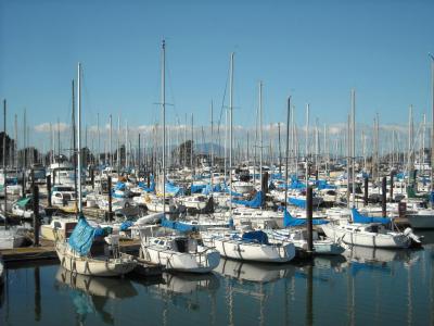
The Berkeley Marina, located at the westernmost edge of Berkeley, extends into the scenic San Francisco Bay. Positioned west of the Eastshore Freeway (Interstate 80 and 580) at the base of University Avenue, the Marina serves as a hub for water-based activities and a popular destination for both locals and visitors. Though the term "Berkeley Marina" technically refers to the city marina itself, it commonly encompasses the surrounding area, rich in recreational opportunities.
The Berkeley Marina is a haven for outdoor enthusiasts, offering kayaking, stand-up paddleboarding, windsurfing, open-water swimming, and kiteboarding. Visitors can enjoy scenic walking and biking paths, including a segment of the San Francisco Bay Trail. The Berkeley I-80 Bridge provides convenient access by foot or bike, connecting the Marina to central Berkeley. The area also marks the western terminus of select trips on AC Transit Route 51B, linking University Avenue and the Rockridge BART station.
The Marina is home to a variety of amenities, including restaurants, a hotel, and a yacht club. The easternmost portion, adjacent to I-80/580, is integrated into Eastshore State Park, further enhancing its appeal as a recreational destination.
Once open waters of San Francisco Bay, the Berkeley Marina's land was gradually filled, largely with landfill. Its history includes the Berkeley Pier (1926), a 3.5-mile ferry link to San Francisco, later used as a fishing pier until 2015; the Municipal Wharf (1909), originally for freight transport; and the Berkeley Yacht Harbor (1930s), built by the Works Progress Administration and used during WWII for Navy tugboat construction. Today, the harbor is a hub for Bay sailors.
Much of the former municipal landfill was transformed into parkland during the 1990s. Originally named North Waterfront Park, it was renamed César Chávez Park in 1996 to honor the renowned labor leader. The park offers open green spaces and stunning views of the Bay, making it a favorite spot for picnicking, dog walking, and flying kites.
The Berkeley Marina is a testament to the city’s evolving relationship with its waterfront, blending historical significance with recreational and environmental transformation.
Want to visit this sight? Check out these Self-Guided Walking Tours in Berkeley. Alternatively, you can download the mobile app "GPSmyCity: Walks in 1K+ Cities" from Apple App Store or Google Play Store. The app turns your mobile device to a personal tour guide and it works offline, so no data plan is needed when traveling abroad.
Download The GPSmyCity App
Berkeley Marina on Map
Sight Name: Berkeley Marina
Sight Location: Berkeley, USA (See walking tours in Berkeley)
Sight Type: Park/Outdoor
Sight Location: Berkeley, USA (See walking tours in Berkeley)
Sight Type: Park/Outdoor
Walking Tours in Berkeley, California

Create Your Own Walk in Berkeley
Creating your own self-guided walk in Berkeley is easy and fun. Choose the city attractions that you want to see and a walk route map will be created just for you. You can even set your hotel as the start point of the walk.
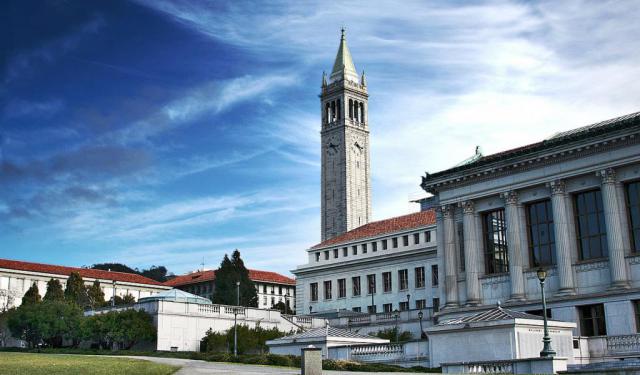
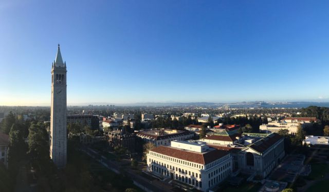
University of California in Berkeley Walking Tour
The University of California, Berkeley, often referred to as UC Berkeley or simply Berkeley, is a part of the larger University of California system, known for its distinguished academics and vibrant campus life. The UC Berkeley campus is the core of Berkeley's attractions. Its design resulted from an 1898 architectural competition, with each building having its own story to tell.
Start... view more
Tour Duration: 2 Hour(s)
Travel Distance: 3.1 Km or 1.9 Miles
Start... view more
Tour Duration: 2 Hour(s)
Travel Distance: 3.1 Km or 1.9 Miles
Berkeley's Historic Landmarks Walking Tour
Berkeley, California, boasts a fair amount of landmarks distinguished for their historical value and representative of the city’s architectural beauty.
One such gem is the Thorsen House, an iconic residence designed by the renowned architectural firm Greene and Green, showcasing the American Craftsman style.
The First Church of Christ, Scientist, is another notable sight. Its mixed design... view more
Tour Duration: 3 Hour(s)
Travel Distance: 4.5 Km or 2.8 Miles
Berkeley Introduction Walking Tour
The Ohlone people were the original inhabitants of the area that is now known as Berkeley, California. Many of them were casualties of the presence of the first settlers of European descent who arrived with the De Anza Expedition of 1776.
Among the soldiers in this expedition was Luis Peralta, who was gifted the land that would become Berkeley by the King of Spain. Peralta gifted the land to... view more
Tour Duration: 2 Hour(s)
Travel Distance: 2.3 Km or 1.4 Miles
Among the soldiers in this expedition was Luis Peralta, who was gifted the land that would become Berkeley by the King of Spain. Peralta gifted the land to... view more
Tour Duration: 2 Hour(s)
Travel Distance: 2.3 Km or 1.4 Miles
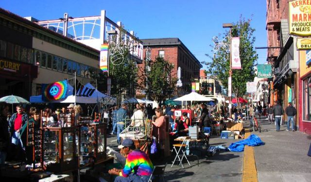
Telegraph Avenue Shopping
In addition to other attractions, the colorful and joyful city of Berkeley, California offers a wide variety of places to shop. Perhaps the most notable among them is Telegraph Avenue, a vibrant and eclectic thoroughfare, featuring a unique blend of cultural diversity and youthful energy.
One of the standout landmarks on Telegraph Avenue is the Berkeley Hat Company. Here, you'll find an... view more
Tour Duration: 1 Hour(s)
Travel Distance: 0.6 Km or 0.4 Miles
One of the standout landmarks on Telegraph Avenue is the Berkeley Hat Company. Here, you'll find an... view more
Tour Duration: 1 Hour(s)
Travel Distance: 0.6 Km or 0.4 Miles