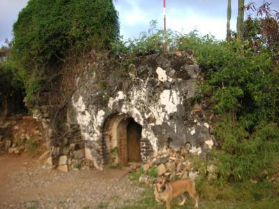


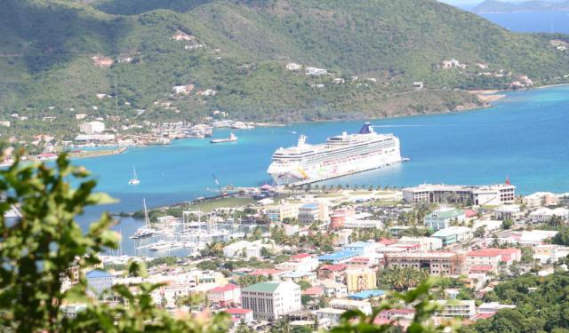
Fort George, Road Town
Although now in ruins, Fort George once formed part of a formidable defensive network of forts surrounding Road Town, strategically positioned to protect the island from potential threats.
The origins of Fort George date back to the early colonial period, with some historians suggesting that the original structure may have been built by the Dutch settlers of the islands to safeguard slave pens constructed in Port Purcell below. It is believed that the fortification was initially established in response to a massacre of the inhabitants of the original settlement in Baugher's Bay in 1625. However, the main fortification, as it stands today, was likely built or rebuilt by the British in the late 18th century around the time of the American War of Independence. It was named (or renamed) after King George III.
During this period, Fort George, along with other forts in the vicinity such as Road Town Fort, Fort Burt, and Fort Charlotte, formed a crucial part of the island's defensive infrastructure. Despite its strategic importance, Fort George never saw combat after its restoration by the British. The combination of formidable defenses and the relatively small strategic and economic significance of Tortola deterred foreign colonial powers, privateers, and pirates from targeting the island.
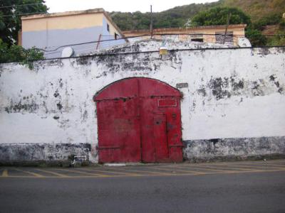
Today, the remains of Fort George are barely recognizable, hidden on private land with no public access. Although featured in the British Virgin Islands government's promotional materials, access to the site depends on the goodwill of the tenants occupying the property. As of recent years, the remains are primarily used for storage, serving as a silent reminder of Tortola's colonial past and its role in the region's history.
The origins of Fort George date back to the early colonial period, with some historians suggesting that the original structure may have been built by the Dutch settlers of the islands to safeguard slave pens constructed in Port Purcell below. It is believed that the fortification was initially established in response to a massacre of the inhabitants of the original settlement in Baugher's Bay in 1625. However, the main fortification, as it stands today, was likely built or rebuilt by the British in the late 18th century around the time of the American War of Independence. It was named (or renamed) after King George III.
During this period, Fort George, along with other forts in the vicinity such as Road Town Fort, Fort Burt, and Fort Charlotte, formed a crucial part of the island's defensive infrastructure. Despite its strategic importance, Fort George never saw combat after its restoration by the British. The combination of formidable defenses and the relatively small strategic and economic significance of Tortola deterred foreign colonial powers, privateers, and pirates from targeting the island.
Today, the remains of Fort George are barely recognizable, hidden on private land with no public access. Although featured in the British Virgin Islands government's promotional materials, access to the site depends on the goodwill of the tenants occupying the property. As of recent years, the remains are primarily used for storage, serving as a silent reminder of Tortola's colonial past and its role in the region's history.
Want to visit this sight? Check out these Self-Guided Walking Tours in Road Town. Alternatively, you can download the mobile app "GPSmyCity: Walks in 1K+ Cities" from Apple App Store or Google Play Store. The app turns your mobile device to a personal tour guide and it works offline, so no data plan is needed when traveling abroad.
Download The GPSmyCity App
Fort George on Map
Sight Name: Fort George
Sight Location: Road Town, British Virgin Island (See walking tours in Road Town)
Sight Type: Attraction/Landmark
Sight Location: Road Town, British Virgin Island (See walking tours in Road Town)
Sight Type: Attraction/Landmark
Nearby Sights

Walking Tours in Road Town, British Virgin Island

Create Your Own Walk in Road Town
Creating your own self-guided walk in Road Town is easy and fun. Choose the city attractions that you want to see and a walk route map will be created just for you. You can even set your hotel as the start point of the walk.
Road Town Introduction Walking Tour
Road Town, capital of the British Virgin Islands, unfolds along the protected curve of Road Harbour on Tortola island's southern coast. Its name comes from the nautical term roadstead, meaning a safe anchorage outside a formal harbour. In essence, “Road Town” means “the town by the anchorage,” a reminder that its natural harbour served mariners long before it became the territory’s... view more
Tour Duration: 1 Hour(s)
Travel Distance: 2.0 Km or 1.2 Miles
Tour Duration: 1 Hour(s)
Travel Distance: 2.0 Km or 1.2 Miles