

Audio Guide: Road Town Introduction Walking Tour (Self Guided), Road Town
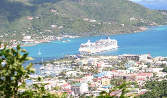
Road Town, capital of the British Virgin Islands, unfolds along the protected curve of Road Harbour on Tortola island's southern coast. Its name comes from the nautical term roadstead, meaning a safe anchorage outside a formal harbour. In essence, “Road Town” means “the town by the anchorage,” a reminder that its natural harbour served mariners long before it became the territory’s political centre.
Long before Europeans arrived, Tortola was inhabited first by the Arawak and later by the Kalinago peoples. In 1493, Christopher Columbus passed the archipelago and named it The Eleven Thousand Virgins, inspired by the legend of Saint Ursula. Despite appearing early on Spanish maps, the islands saw little sustained Spanish settlement.
In the 17th century the Dutch briefly established administrative control, founding a settlement in 1648-the earliest roots of what would become Road Town. Their rule was short-lived: in 1672 the British seized Tortola during the Third Anglo-Dutch War. By the early 18th century, the territory’s capital had shifted from Spanish Town on Virgin Gorda island to Road Town, solidifying its emerging importance.
Throughout the 1700s and 1800s, Road Town grew gradually as the surrounding hills were carved into plantation estates producing cotton and sugar. Enslaved Africans formed the backbone of this economy, and their forced labour shaped the island’s development. Following the abolition of slavery in 1834, formerly enslaved communities established free villages beyond plantation boundaries, transforming the island’s social landscape.
Economic challenges defined much of the late 19th and early 20th centuries, as agricultural markets collapsed and hurricanes devastated infrastructure. Road Town remained a modest administrative centre until mid-century reforms and growing local autonomy set the stage for economic renewal. From the 1960s onward, the rise of tourism and offshore financial services reshaped the capital. Improved maritime facilities turned Road Harbour into one of the Caribbean’s busiest yacht basins, and the city developed into the commercial and governmental heart of the BVI.
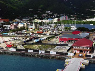
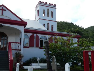
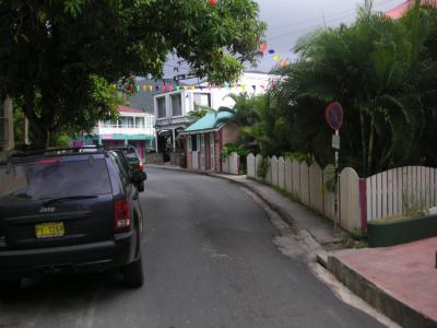
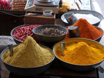
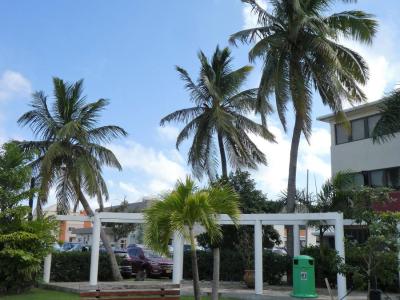
A walk through Road Town leads past colorful Caribbean storefronts, leafy streets, and views of yachts anchored in Road Harbour. Visitors can explore the lively Crafts Alive Village, the historic St. George’s Anglican Church, and the engaging Main Street. The waterfront promenade offers breezy views of the marina, while nearby markets brim with spices, local fruit, and handmade souvenirs. Road Town blends island charm with a relaxed, maritime atmosphere.
End your walk by the water, where the harbour spreads out in front of you. Here, it’s clear that Road Town has never forgotten its beginnings as a safe anchorage-its legacy held together by the same quiet stretch of sea.
Long before Europeans arrived, Tortola was inhabited first by the Arawak and later by the Kalinago peoples. In 1493, Christopher Columbus passed the archipelago and named it The Eleven Thousand Virgins, inspired by the legend of Saint Ursula. Despite appearing early on Spanish maps, the islands saw little sustained Spanish settlement.
In the 17th century the Dutch briefly established administrative control, founding a settlement in 1648-the earliest roots of what would become Road Town. Their rule was short-lived: in 1672 the British seized Tortola during the Third Anglo-Dutch War. By the early 18th century, the territory’s capital had shifted from Spanish Town on Virgin Gorda island to Road Town, solidifying its emerging importance.
Throughout the 1700s and 1800s, Road Town grew gradually as the surrounding hills were carved into plantation estates producing cotton and sugar. Enslaved Africans formed the backbone of this economy, and their forced labour shaped the island’s development. Following the abolition of slavery in 1834, formerly enslaved communities established free villages beyond plantation boundaries, transforming the island’s social landscape.
Economic challenges defined much of the late 19th and early 20th centuries, as agricultural markets collapsed and hurricanes devastated infrastructure. Road Town remained a modest administrative centre until mid-century reforms and growing local autonomy set the stage for economic renewal. From the 1960s onward, the rise of tourism and offshore financial services reshaped the capital. Improved maritime facilities turned Road Harbour into one of the Caribbean’s busiest yacht basins, and the city developed into the commercial and governmental heart of the BVI.
A walk through Road Town leads past colorful Caribbean storefronts, leafy streets, and views of yachts anchored in Road Harbour. Visitors can explore the lively Crafts Alive Village, the historic St. George’s Anglican Church, and the engaging Main Street. The waterfront promenade offers breezy views of the marina, while nearby markets brim with spices, local fruit, and handmade souvenirs. Road Town blends island charm with a relaxed, maritime atmosphere.
End your walk by the water, where the harbour spreads out in front of you. Here, it’s clear that Road Town has never forgotten its beginnings as a safe anchorage-its legacy held together by the same quiet stretch of sea.
How it works: Download the app "GPSmyCity: Walks in 1K+ Cities" from Apple App Store or Google Play Store to your mobile phone or tablet. The app turns your mobile device into a personal tour guide and its built-in GPS navigation functions guide you from one tour stop to next. The app works offline, so no data plan is needed when traveling abroad.
Download The GPSmyCity App
Road Town Introduction Walking Tour Map
Guide Name: Road Town Introduction Walking Tour
Guide Location: British Virgin Island » Road Town (See other walking tours in Road Town)
Guide Type: Self-guided Walking Tour (Sightseeing)
Tour Duration: 1 Hour(s)
Travel Distance: 2.0 Km or 1.2 Miles
Guide Location: British Virgin Island » Road Town (See other walking tours in Road Town)
Guide Type: Self-guided Walking Tour (Sightseeing)
Tour Duration: 1 Hour(s)
Travel Distance: 2.0 Km or 1.2 Miles
Sights Featured in This Walk
4) Main Street (must see)
The Most Popular Cities
/ view all