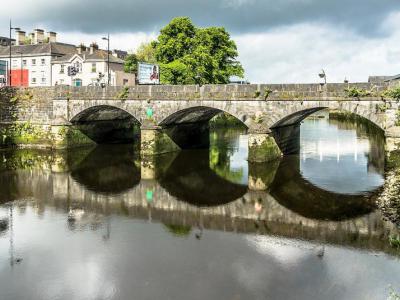


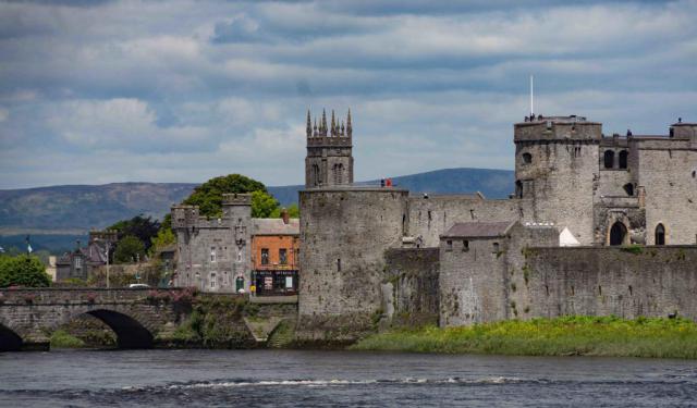
Mathew Bridge, Limerick
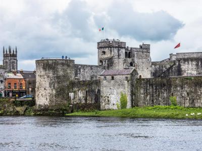
Mathew Bridge is a historic structure that spans the Abbey River in Limerick, linking Rutland Street to Merchant's Quay, Bridge Street, and George's Quay. This bridge, crucial in the development of the city, was constructed in the 1840s during a period marked by significant urban expansion and social movements.
The necessity for Mathew Bridge emerged from the rapid growth of Newtownpery, an area that began to develop following the demolition of Limerick's old city walls in 1761. As the population increased, the existing bridge, erected shortly after the walls were torn down, could no longer handle the daily traffic. Mathew Bridge was built to replace the New Bridge, which had been constructed in 1762 but was insufficient for the growing needs of the city.
Designed by William Henshaw Owen and opened in July 1846, Mathew Bridge was noted for its spacious flat deck and elegant stonework. The construction was overseen by contractor John Duggan, who was also responsible for building the Corporation Widows’ Alms Houses in 1848.
The bridge was named in honor of Father Theobald Mathew, a friar known for initiating a national temperance movement. Remarkably, by 1846, Father Mathew had garnered 180,000 disciples in Limerick alone, a significant feat given the total population of Limerick city and county was about 250,000 at the time. This large number of adherents underscores the profound impact of the temperance movement in the region.
An interesting historical feature of Mathew Bridge is a benchmark located at its center, which marks its position on the nineteenth-century ordnance survey maps. This marker not only highlights the bridge's historical significance but also serves as a testament to its role in the urban development of Limerick during a transformative period in its history.
Want to visit this sight? Check out these Self-Guided Walking Tours in Limerick. Alternatively, you can download the mobile app "GPSmyCity: Walks in 1K+ Cities" from Apple App Store or Google Play Store. The app turns your mobile device to a personal tour guide and it works offline, so no data plan is needed when traveling abroad.
Download The GPSmyCity App
Mathew Bridge on Map
Sight Name: Mathew Bridge
Sight Location: Limerick, Ireland (See walking tours in Limerick)
Sight Type: Attraction/Landmark
Sight Location: Limerick, Ireland (See walking tours in Limerick)
Sight Type: Attraction/Landmark
Nearby Sights

Walking Tours in Limerick, Ireland

Create Your Own Walk in Limerick
Creating your own self-guided walk in Limerick is easy and fun. Choose the city attractions that you want to see and a walk route map will be created just for you. You can even set your hotel as the start point of the walk.
Limerick Introduction Walking Tour
Claudius Ptolemy, the great geographer of the ancient world, drew a map of Ireland in 150 AD. Indicated on the map was a place now called King's Island. It is said generous King Cormac ruled here in the 4th century. Here is where St Patrick baptized King Carthann the Fair in 434. Here is the ancient heart of Limerick.
St Munchin had been the first bishop of Limerick in 652. In 812, Vikings... view more
Tour Duration: 2 Hour(s)
Travel Distance: 3.0 Km or 1.9 Miles
St Munchin had been the first bishop of Limerick in 652. In 812, Vikings... view more
Tour Duration: 2 Hour(s)
Travel Distance: 3.0 Km or 1.9 Miles