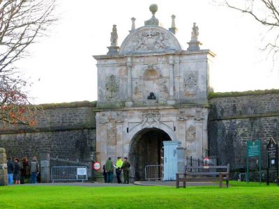


Royal Citadel, Plymouth (must see)
The Royal Citadel of Plymouth, in England, was designed in the late 1660s by military architect Sir Bernard de Gomme. It is located at the east end of Plymouth Hoe, an open land above the limestone cliffs bordering the harbor. It sits on the site of an earlier fort built during the era of Elizabeth I and Sir Francis Drake.
After the defeat of the Spanish Armada, Francis Drake was appointed to perfect the defenses of Plymouth. He built a fort on Plymouth Hoe to command the approaches to Plymouth Harbor. Drake's fort was finished in 1596. It had two bastions, batteries, and a blockhouse dating from 1540.
In the reign of Charles II, during the Dutch Wars of 1664 to 1667, Sir Bernard de Gomme built his fort, encompassing parts of the earlier Tudor construction. The Citadel is mainly of limestone with English Baroque gateways of Portland stone. The walls were as high as 70 feet and equipped with 113 guns.
During Victorian times, the Citadel served as a training facility for the Royal Garrison Artillery. During World War II, the Coast Artillery School made its home there. The Royal Citadel still serves a military purpose for the Royal Artillery and the Royal Marines. Guided tours are occasionally available.
Want to visit this sight? Check out these Self-Guided Walking Tours in Plymouth. Alternatively, you can download the mobile app "GPSmyCity: Walks in 1K+ Cities" from Apple App Store or Google Play Store. The app turns your mobile device to a personal tour guide and it works offline, so no data plan is needed when traveling abroad.
Download The GPSmyCity App
Royal Citadel on Map
Sight Name: Royal Citadel
Sight Location: Plymouth, England (See walking tours in Plymouth)
Sight Type: Attraction/Landmark
Guide(s) Containing This Sight:
Sight Location: Plymouth, England (See walking tours in Plymouth)
Sight Type: Attraction/Landmark
Guide(s) Containing This Sight:
Walking Tours in Plymouth, England

Create Your Own Walk in Plymouth
Creating your own self-guided walk in Plymouth is easy and fun. Choose the city attractions that you want to see and a walk route map will be created just for you. You can even set your hotel as the start point of the walk.
Plymouth Hoe Walking Tour
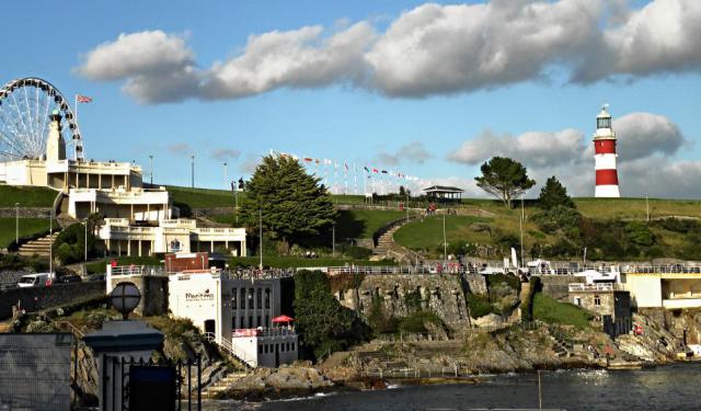
Plymouth Hoe, referred to locally as the Hoe, is a large south-facing open public space in Plymouth with commanding views of Plymouth Sound, Drake's Island, and further afield into Cornwall. The name derives from the Anglo-Saxon word hoh, which means a sloping ridge shaped like an inverted foot and heel.
This part of town has always been a meeting place, where people would come regularly... view more
Tour Duration: 1 Hour(s)
Travel Distance: 0.7 Km or 0.4 Miles
This part of town has always been a meeting place, where people would come regularly... view more
Tour Duration: 1 Hour(s)
Travel Distance: 0.7 Km or 0.4 Miles
Plymouth Introduction Walking Tour
Plymouth's early history began in the Bronze Age when the first settlement emerged at Mount Batten. It is mentioned in Ptolemy's Geographia as a maritime outpost exporting bronze mirrors.
The settlement was a major port in the southwest of England in Roman times. It was surpassed as a port in the ninth century by the nearby wealthier village of Sutton, later called Plymouth.
... view more
Tour Duration: 1 Hour(s)
Travel Distance: 1.9 Km or 1.2 Miles
The settlement was a major port in the southwest of England in Roman times. It was surpassed as a port in the ninth century by the nearby wealthier village of Sutton, later called Plymouth.
... view more
Tour Duration: 1 Hour(s)
Travel Distance: 1.9 Km or 1.2 Miles

Pilgrim Fathers Trail
Back in the early 17th century, a group of English Puritans – nowadays reverently referred to as the Pilgrim Fathers – fled religious persecution in their homeland and established a colony in North America that later became known as Plymouth, Massachusetts. The Pilgrims embarked on their perilous journey across the Atlantic from Plymouth, England in 1620 aboard a ship called the Mayflower,... view more
Tour Duration: 1 Hour(s)
Travel Distance: 0.5 Km or 0.3 Miles
Tour Duration: 1 Hour(s)
Travel Distance: 0.5 Km or 0.3 Miles