

Schreven Park, Kiel
Magnificent Wilhelminian-style buildings surround the spacious park, which is laid out around a lake and has beautiful, old trees. In summer, many students gather on the large lawn to barbecue with a view of the Schreventeich, and in autumn the leaves of the non-European species turn particularly colorful. On the eastern side is the Castello in Schrevenpark, where you can get food and drinks.
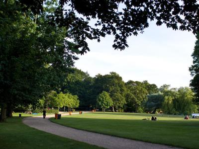
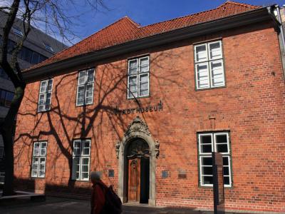
The Schrevenpark is a 12 hectare park in the Schreventeich district. It was created between 1900 and 1902 by the city gardener Ferdinand Hurtzig and opened to the public on July 26, 1902. Until 1947, the park was named Hohenzollern Park in honour of the noble Hohenzollern family. The park was badly damaged in the Second World War. After the war, it was rebuilt in a much simpler form and on December 17, 1947, the council decided to rename it to its current name. This is derived from the Schreventeich, which is located in Schrevenpark. The Schrevenpark itself and some objects in the park are now included in the list of cultural monuments in Kiel-Schreventeich, such as the sculpture " The Slumbering One ". On the eastern side is the Castello in Schrevenpark.
The Schrevenpark in Kiel is a popular meeting place for anyone looking for a green oasis in the city. The park is divided into different areas where visitors can pursue different activities. Due to its age, the park also has an exciting history. Recently we were able to get a taste of the city air again, as we had a business meeting in Kiel. The company we were with has its offices in a building that borders directly on Schrevenpark. And since we were already there and the view of the park looked very promising, we combined business with pleasure and took a walk through the park before driving home. In the middle of the park there is the Schreventeich, which takes up about a third of the park area. It is surrounded by old, very impressive trees and curved paths. The paths that lead through the park also serve as a connecting element for the surrounding districts. The pond used to be of great importance to Kiel, as it was used to ensure the water supply for the castle, the Franciscan monastery and some of the surrounding noble houses. At that time, the water flowed through hollowed-out tree trunks, the "Piepenbäume", into the lower-lying city. In 1862, Kiel acquired the Schreventeich from the sovereign in order to then use it to supply water to its residents. It was only when Kiel's growing water demand could be met by deep wells and a groundwater plant that the Schreventeich was separated from the city's supply network in 1880. At that time, the Schreventeich is said to have been twice as large. Today, it is definitely no longer recognizable that before 1875 the northern part was separated by a dam and silted up. This was filled in and converted into leased gardens. ***PH***
Want to visit this sight? Check out these Self-Guided Walking Tours in Kiel. Alternatively, you can download the mobile app "GPSmyCity: Walks in 1K+ Cities" from Apple App Store or Google Play Store. The app turns your mobile device to a personal tour guide and it works offline, so no data plan is needed when traveling abroad.
Download The GPSmyCity App
Schreven Park on Map
Sight Name: Schreven Park
Sight Location: Kiel, Germany (See walking tours in Kiel)
Sight Type: Park/Outdoor
Sight Location: Kiel, Germany (See walking tours in Kiel)
Sight Type: Park/Outdoor
Nearby Sights


Walking Tours in Kiel, Germany

Create Your Own Walk in Kiel
Creating your own self-guided walk in Kiel is easy and fun. Choose the city attractions that you want to see and a walk route map will be created just for you. You can even set your hotel as the start point of the walk.
Kiel Introduction Walking Tour
Kiel, nestled along Germany’s Baltic coast, is steeped in maritime lore and history. First a Viking settlement, it grew into a humble fishing village before shining in the Middle Ages as a member of the influential Hanseatic League trade confederation. By the 13th century, Kiel had secured its place as a thriving port town strategically positioned on key trade routes.
Fast forward to the 19th... view more
Tour Duration: 2 Hour(s)
Travel Distance: 2.6 Km or 1.6 Miles
Fast forward to the 19th... view more
Tour Duration: 2 Hour(s)
Travel Distance: 2.6 Km or 1.6 Miles