

Independence Square, Port of Spain (must see)
At the time of the first European contact, the Awawakan-speaking indigenous people had set up the fishing village Cumucurapo, which means 'the place of Silk Cotton Trees'; on the western shore of Trinidad, then called "Kairi" (Land of the Hummingbirds). The Spanish established Puerto de Espana (Port of Spain) in 1560. The boat landing place of the old village became Plaza del Marina (Marine Square).
In 1797 the British arrived, led by General Sir Ralph Abercromby. They landed immediately west of Port of Spain at a place still known as "Invaders Bay." The British went about changing place names, and Plaza del Marina became simply "Marine Square." The Square was officially renamed "Independence Square" in 1962.
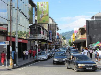
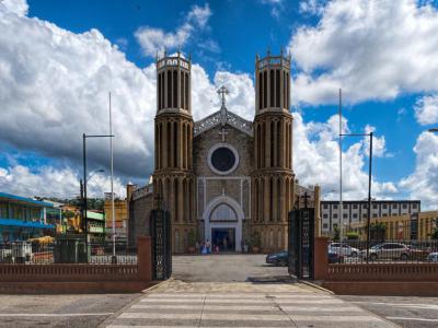
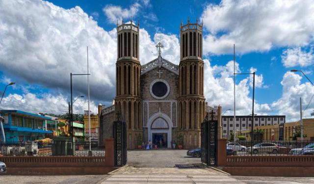
The Square today is an east-to-west elongated rectangle. Partially constructed on reclaimed land, it is bound to the east by the Cathedral of the Immaculate Conception. The western end is the Brian Lara Waterfront Promenade. The north side street is North Independence Square. The southern border road is, naturally, South Independence Square.
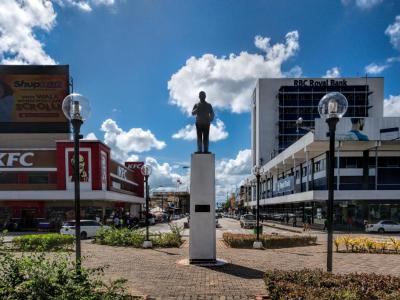
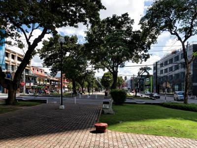
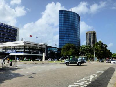
Skyscrapers like the Nicholas Tower and Eric Williams Plaza, named after Eric Williams, the first Prime Minister of Trinidad and Tabaco, are at the western end. Along its length, it is a tree-lined parkway. Fast food places like KFC abound. There is speedy traffic on both sides of the Square. In the middle of the Square is a fountain and a statue of Captain Arthur Andrew Cipriani, politician and sportsman of Trinidad.
In 1797 the British arrived, led by General Sir Ralph Abercromby. They landed immediately west of Port of Spain at a place still known as "Invaders Bay." The British went about changing place names, and Plaza del Marina became simply "Marine Square." The Square was officially renamed "Independence Square" in 1962.
The Square today is an east-to-west elongated rectangle. Partially constructed on reclaimed land, it is bound to the east by the Cathedral of the Immaculate Conception. The western end is the Brian Lara Waterfront Promenade. The north side street is North Independence Square. The southern border road is, naturally, South Independence Square.
Skyscrapers like the Nicholas Tower and Eric Williams Plaza, named after Eric Williams, the first Prime Minister of Trinidad and Tabaco, are at the western end. Along its length, it is a tree-lined parkway. Fast food places like KFC abound. There is speedy traffic on both sides of the Square. In the middle of the Square is a fountain and a statue of Captain Arthur Andrew Cipriani, politician and sportsman of Trinidad.
Want to visit this sight? Check out these Self-Guided Walking Tours in Port of Spain. Alternatively, you can download the mobile app "GPSmyCity: Walks in 1K+ Cities" from Apple App Store or Google Play Store. The app turns your mobile device to a personal tour guide and it works offline, so no data plan is needed when traveling abroad.
Download The GPSmyCity App
Independence Square on Map
Sight Name: Independence Square
Sight Location: Port of Spain, Trinidad and Tobago (See walking tours in Port of Spain)
Sight Type: Attraction/Landmark
Guide(s) Containing This Sight:
Sight Location: Port of Spain, Trinidad and Tobago (See walking tours in Port of Spain)
Sight Type: Attraction/Landmark
Guide(s) Containing This Sight:
Nearby Sights

Walking Tours in Port of Spain, Trinidad and Tobago

Create Your Own Walk in Port of Spain
Creating your own self-guided walk in Port of Spain is easy and fun. Choose the city attractions that you want to see and a walk route map will be created just for you. You can even set your hotel as the start point of the walk.
Port of Spain Introduction Walk
Port of Spain was once the site of a fishing village of Amerindian people. It was called "Place of the silk cotton trees." By 1560, a Spanish garrison was stationed in the area. By 1757, the village had changed to the capital of the Port of Spain.
The last Spanish governor of Trinidad, Don Jose Chacon, opened the colony to French Catholic immigrants. The population grew and the town... view more
Tour Duration: 1 Hour(s)
Travel Distance: 1.7 Km or 1.1 Miles
The last Spanish governor of Trinidad, Don Jose Chacon, opened the colony to French Catholic immigrants. The population grew and the town... view more
Tour Duration: 1 Hour(s)
Travel Distance: 1.7 Km or 1.1 Miles
Historic Buildings Walking Tour
A group of mansions in northern Port of Spain, located on Maraval Road, to the west of the Queen's Park Savannah, is known colloquially as “The Magnificent Seven”. They were built between 1902 and 1910 on the land that was previously used as a government stock farm. Together with the nearby President's House, the official residence of the President of Trinidad and Tobago, which is... view more
Tour Duration: 1 Hour(s)
Travel Distance: 1.1 Km or 0.7 Miles
Tour Duration: 1 Hour(s)
Travel Distance: 1.1 Km or 0.7 Miles