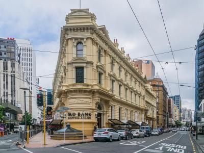


Lambton Quay, Wellington
Lambton Quay is one of Wellington’s main central streets and a key thread through the city’s commercial and administrative life. It forms part of the Golden Mile, the well-known retail and transport corridor that also includes Willis Street, Manners Street, and Courtenay Place. Today, the street is lined with offices, shops, cafés, banks, arcades, and government-related buildings, while the northern end connects naturally with the Parliament precinct and the Wellington Cenotaph.
Its name preserves an older geography. Lambton Quay was once known as The Beach, because it originally followed the high-water line of Wellington harbor. The name Lambton comes from John Lambton, 1st Earl of Durham, whose family name was Lambton and who was associated with the New Zealand Company. The street became an important early business area for the new European settlement of Wellington.
The street’s present inland position tells one of Wellington’s most important physical stories. The 1855 Wairarapa earthquake lifted land around Wellington harbor, while later reclamation pushed the shoreline even farther away. As a result, Lambton Quay now lies about 250 meters from the water, despite its name still suggesting a waterfront road. Its curved line still hints at the old foreshore, making it one of the easiest places in the city center to see how Wellington grew outward from the harbor.
Its name preserves an older geography. Lambton Quay was once known as The Beach, because it originally followed the high-water line of Wellington harbor. The name Lambton comes from John Lambton, 1st Earl of Durham, whose family name was Lambton and who was associated with the New Zealand Company. The street became an important early business area for the new European settlement of Wellington.
The street’s present inland position tells one of Wellington’s most important physical stories. The 1855 Wairarapa earthquake lifted land around Wellington harbor, while later reclamation pushed the shoreline even farther away. As a result, Lambton Quay now lies about 250 meters from the water, despite its name still suggesting a waterfront road. Its curved line still hints at the old foreshore, making it one of the easiest places in the city center to see how Wellington grew outward from the harbor.
Want to visit this sight? Check out these Self-Guided Walking Tours in Wellington. Alternatively, you can download the mobile app "GPSmyCity: Walks in 1K+ Cities" from Apple App Store or Google Play Store. The app turns your mobile device to a personal tour guide and it works offline, so no data plan is needed when traveling abroad.
Download The GPSmyCity App



Lambton Quay on Map
Sight Name: Lambton Quay
Sight Location: Wellington, New Zealand (See walking tours in Wellington)
Sight Type: Attraction/Landmark
Guide(s) Containing This Sight:
Sight Location: Wellington, New Zealand (See walking tours in Wellington)
Sight Type: Attraction/Landmark
Guide(s) Containing This Sight:
Nearby Sights
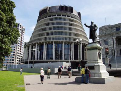
Walking Tours in Wellington, New Zealand
Create Your Own Walk in Wellington
Creating your own self-guided walk in Wellington is easy and fun. Choose the city attractions that you want to see and a walk route map will be created just for you. You can even set your hotel as the start point of the walk.
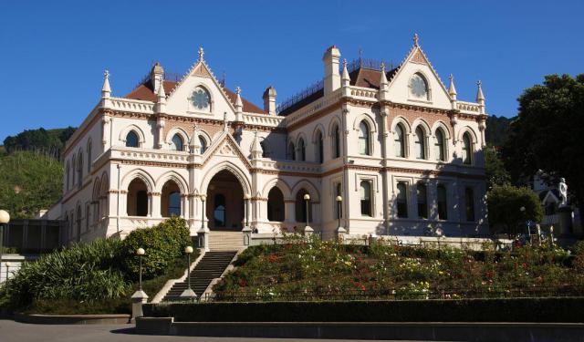
Historical Buildings Walking Tour
The first immigrants to New Zealand brought along their sense of style. Most of the country's first settlers, if not all of them, were Britishers; the capital city was no exception. The latter fact is duly reflected in Wellington's historical architecture. These buildings offer a glimpse into the city's past and add a great deal of charm to the cityscape. Let's take a quick... view more
Tour Duration: 2 Hour(s)
Travel Distance: 3.5 Km or 2.2 Miles
Tour Duration: 2 Hour(s)
Travel Distance: 3.5 Km or 2.2 Miles
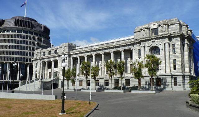
Wellington City Center Walking Tour
New Zealand writer Katherine Mansfield saw Wellington as a town set at the edge of a deep harbor, with hills rising behind it and timber houses climbing into view. More than a century later, the city still feels arranged by the same forces: water, wind, slopes, and human stubbornness.
Wellington has a history shaped by harbor, migration, colonization, earthquakes, and government. Its Maori... view more
Tour Duration: 2 Hour(s)
Travel Distance: 3.6 Km or 2.2 Miles
Wellington has a history shaped by harbor, migration, colonization, earthquakes, and government. Its Maori... view more
Tour Duration: 2 Hour(s)
Travel Distance: 3.6 Km or 2.2 Miles