

Wellington Introduction Walking Tour (Self Guided), Wellington
New Zealand writer Katherine Mansfield saw Wellington as a town set at the edge of a deep harbor, with hills rising behind it and timber houses climbing into view. More than a century later, the city still feels arranged by the same forces: water, wind, slopes, and human stubbornness.
Wellington has a history shaped by harbor, migration, colonization, earthquakes, and government. Its Maori name means “the great harbor of Tara”, referring to the son of the Polynesian explorer Whatonga. According to the legend, Whatonga told his son, Tara, to travel south to find more fertile lands to settle.
European settlement began in earnest in 1839, when the New Zealand Company sent representatives to choose a site for its first organized colony. The first intended location near the mouth of the Hutt River proved unsuitable, so settlement shifted to the west side of the harbor. In 1840, the new settlement was named Wellington in honor of Arthur Wellesley, the 1st Duke of Wellington, best remembered as the victor of the Battle of Waterloo.
The young town grew around its port, which became central to trade, migration, and administration. Wellington was made a borough in 1842 and later a city in 1886. Its development, however, was not easy. The rugged hills limited expansion, while earthquakes repeatedly reshaped both the city and its shoreline. The major Wairarapa earthquake of 1855 lifted land around the harbor, helping create areas later reclaimed and built over. This partly explains why places such as Lambton Quay, once close to the water, now sit inland.
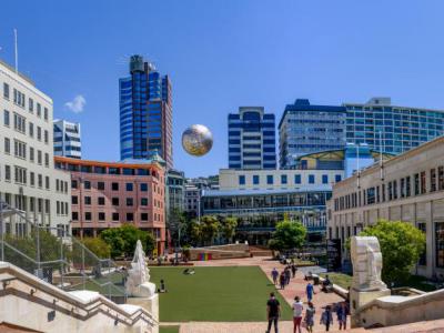
Wellington’s national role was secured in 1865, when New Zealand’s capital was moved here from Auckland. Its central position, between the North and South Islands, made it a practical compromise for a growing colony. In the 20th and 21st centuries, Wellington developed beyond politics into a compact cultural capital, known for museums, film, theater, cafés, universities, and a lively waterfront.
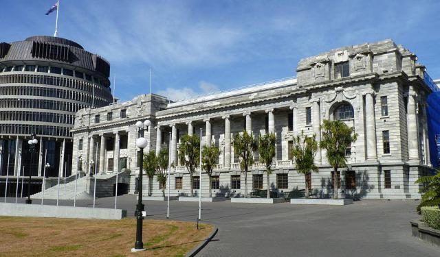
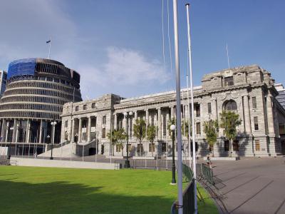
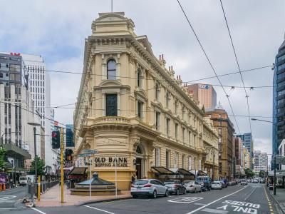
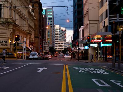
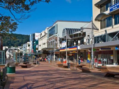
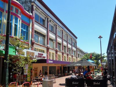
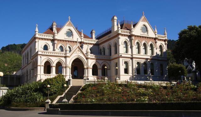
Walking through the city center of Wellington, visitors encounter a compact capital framed by hills and harbor views. Highlights include the elegant Old Government Buildings, the Old Saint Paul’s, and the bustling waterfront. Farther on, Cuba Street adds color, cafés, street life, and Wellington’s more relaxed creative spirit.
By the end of the walk, Mansfield’s Wellington no longer feels like a scene observed from a distance, but a city experienced step by step. The harbor still sets the stage, the hills still press close, the timber buildings still carry traces of earlier lives, and the wind still insists on joining the conversation.
Wellington has a history shaped by harbor, migration, colonization, earthquakes, and government. Its Maori name means “the great harbor of Tara”, referring to the son of the Polynesian explorer Whatonga. According to the legend, Whatonga told his son, Tara, to travel south to find more fertile lands to settle.
European settlement began in earnest in 1839, when the New Zealand Company sent representatives to choose a site for its first organized colony. The first intended location near the mouth of the Hutt River proved unsuitable, so settlement shifted to the west side of the harbor. In 1840, the new settlement was named Wellington in honor of Arthur Wellesley, the 1st Duke of Wellington, best remembered as the victor of the Battle of Waterloo.
The young town grew around its port, which became central to trade, migration, and administration. Wellington was made a borough in 1842 and later a city in 1886. Its development, however, was not easy. The rugged hills limited expansion, while earthquakes repeatedly reshaped both the city and its shoreline. The major Wairarapa earthquake of 1855 lifted land around the harbor, helping create areas later reclaimed and built over. This partly explains why places such as Lambton Quay, once close to the water, now sit inland.
Wellington’s national role was secured in 1865, when New Zealand’s capital was moved here from Auckland. Its central position, between the North and South Islands, made it a practical compromise for a growing colony. In the 20th and 21st centuries, Wellington developed beyond politics into a compact cultural capital, known for museums, film, theater, cafés, universities, and a lively waterfront.
Walking through the city center of Wellington, visitors encounter a compact capital framed by hills and harbor views. Highlights include the elegant Old Government Buildings, the Old Saint Paul’s, and the bustling waterfront. Farther on, Cuba Street adds color, cafés, street life, and Wellington’s more relaxed creative spirit.
By the end of the walk, Mansfield’s Wellington no longer feels like a scene observed from a distance, but a city experienced step by step. The harbor still sets the stage, the hills still press close, the timber buildings still carry traces of earlier lives, and the wind still insists on joining the conversation.
How it works: Download the app "GPSmyCity: Walks in 1K+ Cities" from Apple App Store or Google Play Store to your mobile phone or tablet. The app turns your mobile device into a personal tour guide and its built-in GPS navigation functions guide you from one tour stop to next. The app works offline, so no data plan is needed when traveling abroad.
Download The GPSmyCity App
Wellington Introduction Walking Tour Map
Guide Name: Wellington Introduction Walking Tour
Guide Location: New Zealand » Wellington (See other walking tours in Wellington)
Guide Type: Self-guided Walking Tour (Sightseeing)
Tour Duration: 2 Hour(s)
Travel Distance: 3.6 Km or 2.2 Miles
Guide Location: New Zealand » Wellington (See other walking tours in Wellington)
Guide Type: Self-guided Walking Tour (Sightseeing)
Tour Duration: 2 Hour(s)
Travel Distance: 3.6 Km or 2.2 Miles
Sights Featured in This Walk
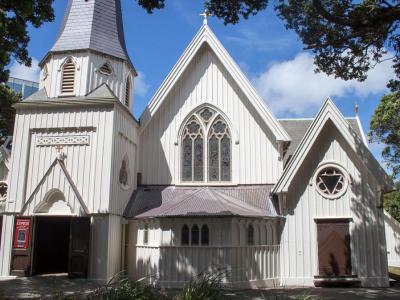
2) Old St. Paul's (must see)

8) Cuba Street (must see)
Walking Tours in Wellington, New Zealand

Create Your Own Walk in Wellington
Creating your own self-guided walk in Wellington is easy and fun. Choose the city attractions that you want to see and a walk route map will be created just for you. You can even set your hotel as the start point of the walk.
Historical Buildings Walking Tour
The first immigrants to New Zealand brought along their sense of style. Most of the country's first settlers, if not all of them, were Britishers; the capital city was no exception. The latter fact is duly reflected in Wellington's historical architecture. These buildings offer a glimpse into the city's past and add a great deal of charm to the cityscape. Let's take a quick... view more
Tour Duration: 2 Hour(s)
Travel Distance: 3.5 Km or 2.2 Miles
Tour Duration: 2 Hour(s)
Travel Distance: 3.5 Km or 2.2 Miles
The Most Popular Cities
/ view all