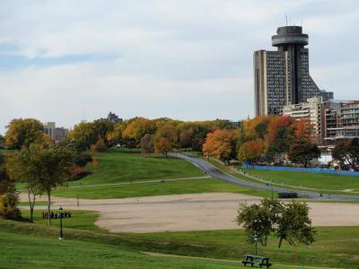


Plains of Abraham / Battlefield Park, Quebec City (must see)
After Champlain arrived in 1608, there were skirmishes on and off between the French and the British, vying for control of the North American colonies. But it wasn’t until September 13, 1759, that the real battle took place, which would forever change the course of North American history. It was all over in 15 minutes – the French fell to the British, and five days later, Quebec capitulated.
The peculiar name “Plains of Abraham” dates back as far as 1635, when Abraham Martin, a pilot of the Saint Lawrence and a friend of Samuel de Champlain, was given 12 acres of land in this area. Today, there is little trace of the battle on the rolling green hills of the plains that border the cliff above the river.
The grandiose stone building found in the Plains houses the park's museum and interpretation center, which offers a multimedia exhibit of its history, from the battle to its popularity with prostitutes in the 19th century, as well as a choice spot for duels, hangings, and the Stanley Cup playoffs. The park itself, designed by Frederick Todd, was part of the 300th anniversary of the Peace and Friendship Treaty of 1726 celebrations. Many of the cannons that line the park were gifts from other nations to remind people that this was once a battlefield.
If you're interested in doing more than just strolling and picnicking in the park, you can head to the Plains of Abraham Museum, where you can visit the Battles 1759-1760 exhibit, which features first-hand soldiers' accounts, battle paraphernalia, and immersive video. Otherwise, the park is very well maintained, and you can walk around the battlefields freely without taking a guided tour, as explanatory signs are everywhere.
Tip:
Combine your visit with the Joan of Arc Garden and the Citadel, and make sure to explore all the streets and shops nearby.
The peculiar name “Plains of Abraham” dates back as far as 1635, when Abraham Martin, a pilot of the Saint Lawrence and a friend of Samuel de Champlain, was given 12 acres of land in this area. Today, there is little trace of the battle on the rolling green hills of the plains that border the cliff above the river.
The grandiose stone building found in the Plains houses the park's museum and interpretation center, which offers a multimedia exhibit of its history, from the battle to its popularity with prostitutes in the 19th century, as well as a choice spot for duels, hangings, and the Stanley Cup playoffs. The park itself, designed by Frederick Todd, was part of the 300th anniversary of the Peace and Friendship Treaty of 1726 celebrations. Many of the cannons that line the park were gifts from other nations to remind people that this was once a battlefield.
If you're interested in doing more than just strolling and picnicking in the park, you can head to the Plains of Abraham Museum, where you can visit the Battles 1759-1760 exhibit, which features first-hand soldiers' accounts, battle paraphernalia, and immersive video. Otherwise, the park is very well maintained, and you can walk around the battlefields freely without taking a guided tour, as explanatory signs are everywhere.
Tip:
Combine your visit with the Joan of Arc Garden and the Citadel, and make sure to explore all the streets and shops nearby.
Want to visit this sight? Check out these Self-Guided Walking Tours in Quebec City. Alternatively, you can download the mobile app "GPSmyCity: Walks in 1K+ Cities" from Apple App Store or Google Play Store. The app turns your mobile device to a personal tour guide and it works offline, so no data plan is needed when traveling abroad.
Download The GPSmyCity App



Plains of Abraham / Battlefield Park on Map
Sight Name: Plains of Abraham / Battlefield Park
Sight Location: Quebec City, Canada (See walking tours in Quebec City)
Sight Type: Attraction/Landmark
Guide(s) Containing This Sight:
Sight Location: Quebec City, Canada (See walking tours in Quebec City)
Sight Type: Attraction/Landmark
Guide(s) Containing This Sight:
Nearby Sights

Walking Tours in Quebec City, Quebec
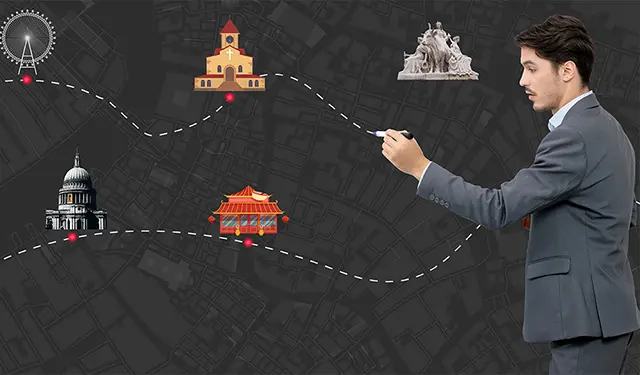
Create Your Own Walk in Quebec City
Creating your own self-guided walk in Quebec City is easy and fun. Choose the city attractions that you want to see and a walk route map will be created just for you. You can even set your hotel as the start point of the walk.
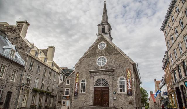
Qucbec City's Historical Churches Walking Tour
The first religious buildings in Canada were established by the Récollets and Jesuits, in 1615 and 1625, respectively, when they first arrived in New France. Later on, the French colonists brought along their culture and architectural traditions, and the establishment of British and evangelical society triggered further major developments in Quebec City.
Over the course of the 17th and 18th... view more
Tour Duration: 1 Hour(s)
Travel Distance: 2.9 Km or 1.8 Miles
Over the course of the 17th and 18th... view more
Tour Duration: 1 Hour(s)
Travel Distance: 2.9 Km or 1.8 Miles
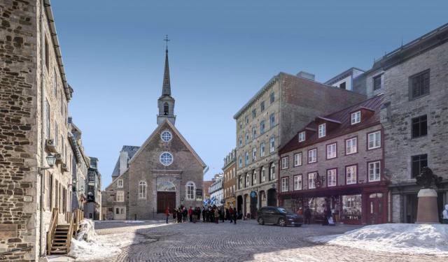
Old Quebec Walk
The historic part of Quebec City known as Old Quebec (French: Vieux-Québec), sometimes also referred to as the Latin Quarter (Quartier Latin), is the neighborhood centered around Cape Diamond (Cap Diamant), located on the eastern edge of Quebec hill promontory. The area comprises Upper Town (Haute-Ville) and Lower Town (Basse-Ville) and is currently listed among UNESCO’s World Heritage Sites.
... view more
Tour Duration: 2 Hour(s)
Travel Distance: 2.6 Km or 1.6 Miles
... view more
Tour Duration: 2 Hour(s)
Travel Distance: 2.6 Km or 1.6 Miles
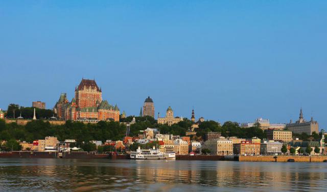
Quebec City Introduction Walking Tour
Cresting a cliff above the St. Lawrence River, Quebec City is the soul of the province of Quebec – a place all its own; a country within a country with its own traditions, architecture, and French-speaking population.
The Algonquian people had originally named this area Kébec, which means "where the river narrows", because the Saint Lawrence River indeed narrows proximate to the... view more
Tour Duration: 2 Hour(s)
Travel Distance: 3.2 Km or 2 Miles
The Algonquian people had originally named this area Kébec, which means "where the river narrows", because the Saint Lawrence River indeed narrows proximate to the... view more
Tour Duration: 2 Hour(s)
Travel Distance: 3.2 Km or 2 Miles
Historical Houses Walking Tour
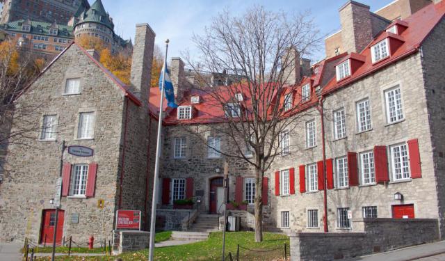
Quebec City, particularly evocative of Europe in its atmosphere, is often referred to as the cradle of New France. The city boasts one of the richest architectural heritages in North America, though most of its buildings had to be adapted to harsh winters and the lack of specialized workers and materials in the colony. As such, the majority of local houses were designed as simple and efficient... view more
Tour Duration: 2 Hour(s)
Travel Distance: 2.5 Km or 1.6 Miles
Tour Duration: 2 Hour(s)
Travel Distance: 2.5 Km or 1.6 Miles