

Plaza Zabala (Zabala Square), Montevideo
Bruno Mauricio de Zabala, a Spanish military officer, played a key role in securing Spanish control of the River Plate in the early 18th century. To strengthen Spain’s presence in the region, Zabala ordered the establishment of a fortified settlement on the coast in 1726. The coastal fortress built under Zabala remained a defining feature of the site for more than a century. In 1878, during the rule of Colonel Lorenzo Latorre, the decision was made to demolish the old fortifications and convert the area into a public square.
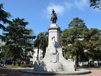
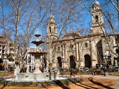
The square itself was officially inaugurated in December 1890, but without a central monument. The equestrian statue of Zabala was installed much later and inaugurated on December 27, 1931. The statue stands at the center of the square, with Zabala on horseback oriented toward the north.
The landscaped gardens surrounding the monument were designed by French landscape architect Édouard André. His plan organizes the square with radial walkways leading inward to the statue, framed by structured greenery and enclosed by ornamental iron fences and gates. The square is fully encircled by Durango Ring Road, the ring street that traces the former defensive perimeter and is named after Zabala’s birthplace.
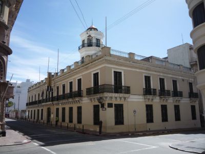
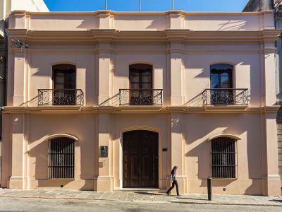
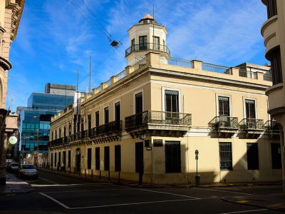
On the southern edge of the square, facing the gardens, stands Taranco Palace, now the Museum of Decorative Arts. Together, the square, monument, and surrounding buildings mark Montevideo’s shift from fortified outpost to civic capital, visible in both layout and orientation.
The square itself was officially inaugurated in December 1890, but without a central monument. The equestrian statue of Zabala was installed much later and inaugurated on December 27, 1931. The statue stands at the center of the square, with Zabala on horseback oriented toward the north.
The landscaped gardens surrounding the monument were designed by French landscape architect Édouard André. His plan organizes the square with radial walkways leading inward to the statue, framed by structured greenery and enclosed by ornamental iron fences and gates. The square is fully encircled by Durango Ring Road, the ring street that traces the former defensive perimeter and is named after Zabala’s birthplace.
On the southern edge of the square, facing the gardens, stands Taranco Palace, now the Museum of Decorative Arts. Together, the square, monument, and surrounding buildings mark Montevideo’s shift from fortified outpost to civic capital, visible in both layout and orientation.
Want to visit this sight? Check out these Self-Guided Walking Tours in Montevideo. Alternatively, you can download the mobile app "GPSmyCity: Walks in 1K+ Cities" from Apple App Store or Google Play Store. The app turns your mobile device to a personal tour guide and it works offline, so no data plan is needed when traveling abroad.
Download The GPSmyCity App
Plaza Zabala (Zabala Square) on Map
Sight Name: Plaza Zabala (Zabala Square)
Sight Location: Montevideo, Uruguay (See walking tours in Montevideo)
Sight Type: Attraction/Landmark
Guide(s) Containing This Sight:
Sight Location: Montevideo, Uruguay (See walking tours in Montevideo)
Sight Type: Attraction/Landmark
Guide(s) Containing This Sight:
Nearby Sights

Walking Tours in Montevideo, Uruguay

Create Your Own Walk in Montevideo
Creating your own self-guided walk in Montevideo is easy and fun. Choose the city attractions that you want to see and a walk route map will be created just for you. You can even set your hotel as the start point of the walk.
Prado District Walking Tour
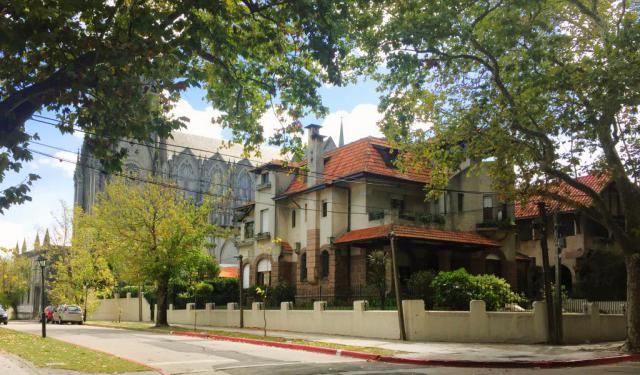
The Prado is one of Montevideo’s oldest and most historically layered districts, shaped by a long transition from rural outskirts to a residential and cultural area closely linked to the city’s elite and intellectual life. The name Prado comes from the Spanish word for “meadow” or “pasture”, reflecting the area’s original landscape: open grasslands along the Miguelete Stream.
... view more
Tour Duration: 2 Hour(s)
Travel Distance: 3.6 Km or 2.2 Miles
... view more
Tour Duration: 2 Hour(s)
Travel Distance: 3.6 Km or 2.2 Miles
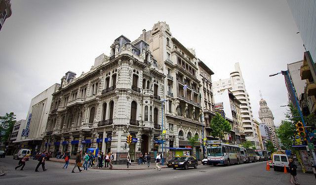
Montevideo Old Town Walking Tour
In Charles Darwin's journals, who visited Montevideo in the 1830s during the voyage of the Beagle, he observed that the city felt like “a town living in a state of perpetual expectation”, shaped by sieges, trade, and uncertainty.
Montevideo is the capital and largest city of Uruguay, shaped by its position on the northern bank of the River Plate and by centuries of rivalry between... view more
Tour Duration: 2 Hour(s)
Travel Distance: 2.5 Km or 1.6 Miles
Montevideo is the capital and largest city of Uruguay, shaped by its position on the northern bank of the River Plate and by centuries of rivalry between... view more
Tour Duration: 2 Hour(s)
Travel Distance: 2.5 Km or 1.6 Miles