

Tomnahurich Cemetery, Inverness
Tomnahurich Cemetery, a quintessential Victorian burial ground, is nestled on a prominent hill 1.5 km southwest of Inverness city center, between the Caledonian Canal and the River Ness. Its name, Tomnahurich, derives from the Scottish Gaelic, meaning "hill of the yew wood," as identified by Professor W.J. Watson in his seminal 1926 work, The Celtic Place-Names of Scotland. Notably, Watson himself rests here beneath an elegant monument.
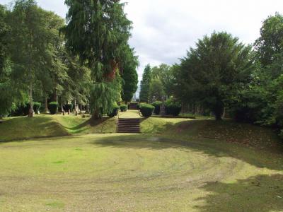
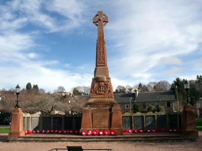
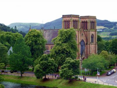
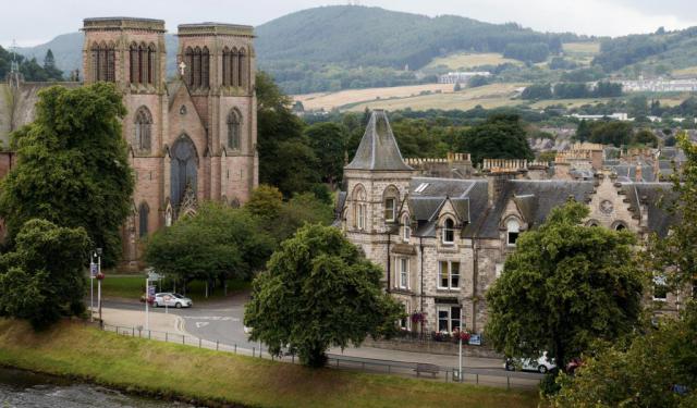
The cemetery spans the hilltop and surrounding lower grounds. The Upper Cemetery, atop the 70-meter plateau, features formal graveyards, a war memorial, and stunning views of Inverness, the Moray Firth, and Ness Valley. The wooded Lower Cemetery encircles the hill, with footpaths winding through bird-filled greenery, making Tomnahurich Hill a striking natural and historical landmark.
Before its transformation into a cemetery, the hill served as a gathering site for community events, including an annual horse race in late May. Its poor agricultural soil led to a reforestation project in 1753, primarily with Pinus sylvestris (Scots pine). Artists and scientists, such as Thomas Pennant in the 18th century, marveled at the hill’s panoramic vistas, further cementing its cultural significance.
The modern cemetery was developed by the Inverness Cemetery Company and opened in 1864, with design work attributed to Charles Heath Wilson and engineering contributions from George Grant Mackay. The site expanded gradually and was acquired by the Borough of Inverness in 1909. During World War II, metal materials from the cemetery were requisitioned for the national war effort.
Tomnahurich Cemetery is dotted with historic and architecturally notable monuments. Among these are the memorial to Mary Anne Lyall, crafted by Andrew Davidson (1841–1925), the Henry Christie Mausoleum, featuring a striking armed angel guarding its marble door, and the lodge at the main entrance, designed by Alexander Ross in 1877.
The cemetery, with its combination of natural beauty, panoramic views, and Victorian design, is a poignant reminder of Inverness’s history and heritage.
Want to visit this sight? Check out these Self-Guided Walking Tours in Inverness. Alternatively, you can download the mobile app "GPSmyCity: Walks in 1K+ Cities" from Apple App Store or Google Play Store. The app turns your mobile device to a personal tour guide and it works offline, so no data plan is needed when traveling abroad.
Download The GPSmyCity App
Tomnahurich Cemetery on Map
Sight Name: Tomnahurich Cemetery
Sight Location: Inverness, Scotland (See walking tours in Inverness)
Sight Type: Attraction/Landmark
Sight Location: Inverness, Scotland (See walking tours in Inverness)
Sight Type: Attraction/Landmark
Nearby Sights


Walking Tours in Inverness, Scotland

Create Your Own Walk in Inverness
Creating your own self-guided walk in Inverness is easy and fun. Choose the city attractions that you want to see and a walk route map will be created just for you. You can even set your hotel as the start point of the walk.
Inverness Introduction Walking Tour
Often regarded as the Capital of the Scottish Highlands, Inverness is steeped in history and legend. The name "Inverness" derives from the Scottish Gaelic "Inbhir Nis," which means "mouth of the River Ness," a fitting moniker for a city that thrives along the banks of this scenic waterway.
The Inverness area has been inhabited since 6500 BC, once being a... view more
Tour Duration: 2 Hour(s)
Travel Distance: 2.3 Km or 1.4 Miles
The Inverness area has been inhabited since 6500 BC, once being a... view more
Tour Duration: 2 Hour(s)
Travel Distance: 2.3 Km or 1.4 Miles

Inverness Historical Buildings Walking Tour
Inverness, a city established in the 12th century, boasts an array of historical architecture reflecting its rich and often tumultuous past. Many of its centuries-old buildings are situated along the banks of the River Ness and blend effortlessly with the surrounding landscape.
Undoubtedly, prime among these is the Inverness Castle, perched majestically atop a hill overlooking the city.... view more
Tour Duration: 2 Hour(s)
Travel Distance: 2.0 Km or 1.2 Miles
Undoubtedly, prime among these is the Inverness Castle, perched majestically atop a hill overlooking the city.... view more
Tour Duration: 2 Hour(s)
Travel Distance: 2.0 Km or 1.2 Miles