

Akrotiri Excavation Site, Santorini (must see)
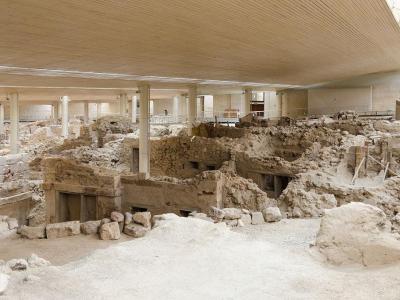
The Akrotiri Excavation Site in Santorini is a significant archaeological site that unveils a well-preserved Cycladic Bronze Age settlement. Named after the nearby village of Akrotiri, this site offers a unique glimpse into ancient life due to its exceptional preservation in volcanic ash from the Theran eruption in the 16th century BCE.
The earliest signs of human activity at Akrotiri date back to the fifth millennium BCE, starting as a modest fishing and farming village. By the end of the third millennium BCE, Akrotiri had developed into a thriving community, likely bolstered by trade with other Aegean cultures, as evidenced by foreign pottery fragments found at the site. Its strategic location on the main sailing route between Cyprus and Minoan Crete further facilitated its growth, particularly in the copper trade. This prosperity is reflected in the settlement’s sophisticated infrastructure, which included paved streets, an extensive drainage system, and advanced craft production.
Excavations on Santorini started in the 19th century, but it was Spyridon Marinatos's comprehensive excavations in 1967 that unveiled the significance of Akrotiri. Marinatos's efforts led to the discovery of the buried city, revealing buildings preserved to heights of more than one story, which posed distinctive challenges for the excavation process.
Excavated artifacts are now housed in the Museum of Prehistoric Thera, showcasing a wide array of objects and artworks, including pottery, which is abundant due to the sudden evacuation of the town. The variety of pottery found, from storage jars to cooking vessels, provides insight into the daily life and activities of the settlement’s inhabitants.
One noteworthy aspect of the excavation is the preservation of furniture. Volcanic ash created molds of disintegrated wooden objects, allowing archaeologists to use plaster to create casts of furniture, such as beds and tables. Offering tables, often found at the site, were made of clay or plaster and decorated similarly to wall paintings.
Why You Should Visit:
Very carefully prepared space showing a whole village's old buildings and life. Excellent guides and lots of information.
The whole area is covered with a hi-tech roof, so you can walk without being grilled by the sun.
Want to visit this sight? Check out these Self-Guided Walking Tours in Santorini. Alternatively, you can download the mobile app "GPSmyCity: Walks in 1K+ Cities" from Apple App Store or Google Play Store. The app turns your mobile device to a personal tour guide and it works offline, so no data plan is needed when traveling abroad.
Download The GPSmyCity App
Akrotiri Excavation Site on Map
Sight Name: Akrotiri Excavation Site
Sight Location: Santorini, Greece (See walking tours in Santorini)
Sight Type: Attraction/Landmark
Sight Location: Santorini, Greece (See walking tours in Santorini)
Sight Type: Attraction/Landmark
Nearby Sights

Walking Tours in Santorini, Greece

Create Your Own Walk in Santorini
Creating your own self-guided walk in Santorini is easy and fun. Choose the city attractions that you want to see and a walk route map will be created just for you. You can even set your hotel as the start point of the walk.
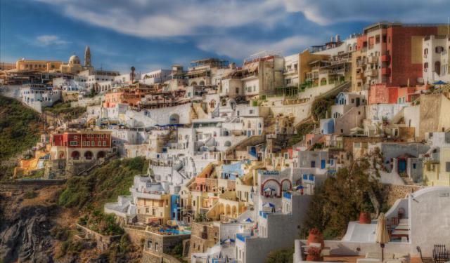
Fira Walking Tour
Known in antiquity as Thera, the island was originally a roughly circular landmass shaped by volcanic activity in the southern Aegean. Its earliest known settlement dates to the Neolithic period, but Santorini entered history more clearly during the Bronze Age, when it developed into an important center of Cycladic and later Minoan civilization.
Around the 17th century BCE, Santorini... view more
Tour Duration: 2 Hour(s)
Travel Distance: 3.4 Km or 2.1 Miles
Around the 17th century BCE, Santorini... view more
Tour Duration: 2 Hour(s)
Travel Distance: 3.4 Km or 2.1 Miles
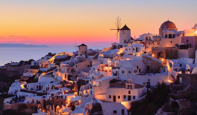
Oia Walking Tour
Oia is one of the oldest settlements on Santorini, with a history shaped by geography, seafaring, and repeated cycles of destruction and rebuilding. The village occupies the northwestern edge of the island, set along the rim of the volcanic caldera. This elevated position offered both strategic advantages and exposure to natural forces, particularly earthquakes, which have repeatedly altered the... view more
Tour Duration: 1 Hour(s)
Travel Distance: 1.0 Km or 0.6 Miles
Tour Duration: 1 Hour(s)
Travel Distance: 1.0 Km or 0.6 Miles
Firostefani and Imerovigli Walking Tour
Away from the crowded Fira yet close to the famous Santorini caldera, there are two small settlements: Firostefani and Imerovigli. Each of these gorgeous neighborhoods has something unique to offer, and thus represents an attraction in its own right.
The quaint village of Firostefani, whose name translates as "The Crown of Fira", is now considered a suburb of Santorini's capital,... view more
Tour Duration: 1 Hour(s)
Travel Distance: 2.3 Km or 1.4 Miles
The quaint village of Firostefani, whose name translates as "The Crown of Fira", is now considered a suburb of Santorini's capital,... view more
Tour Duration: 1 Hour(s)
Travel Distance: 2.3 Km or 1.4 Miles