

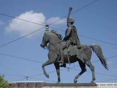
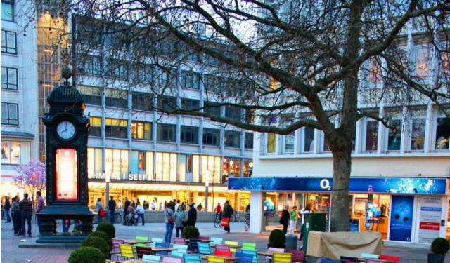
Kropcke Platz (Kropcke Square), Hanover
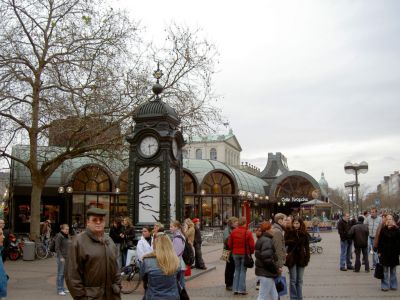
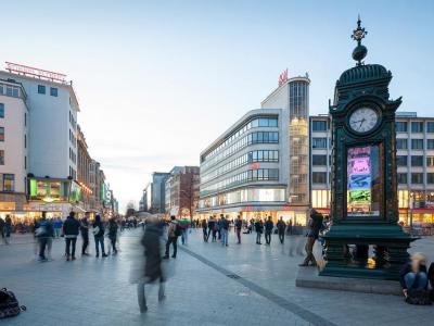
Kroepcke is the central square of Hanover, positioned at the intersection of several main pedestrian streets and forming the city’s geographic and social core. It is difficult to miss—largely because it is unavoidable. Most routes through the centre pass here, and locals commonly use it as a meeting point. Beneath the square lies the largest hub of the city’s light rail system.
The intersection dates back to 1843, when it emerged as part of a broader urban expansion plan intended to replace a nearby market square. Horse-drawn trams appeared in the 1870s and were later electrified in the 20th century. The square takes its name from the former Cafe Kroepcke, an ornate cast-iron structure inspired by Parisian cafes. Opened in 1867 as Cafe Robby and later run by Wilhelm Kroepcke, it became so well known that the entire square adopted its name, officially in 1948.
Heavily bombed during World War II, the area was largely destroyed, with only the famous Kroepcke Clock surviving, though in damaged form. Originally installed in 1885 as a weather column, it was replaced after the war and simplified in 1977. Since the 1970s, the square has been pedestrian-only, creating an open urban space above a busy transport network.
Want to visit this sight? Check out these Self-Guided Walking Tours in Hanover. Alternatively, you can download the mobile app "GPSmyCity: Walks in 1K+ Cities" from Apple App Store or Google Play Store. The app turns your mobile device to a personal tour guide and it works offline, so no data plan is needed when traveling abroad.
Download The GPSmyCity App
Kropcke Platz (Kropcke Square) on Map
Sight Name: Kropcke Platz (Kropcke Square)
Sight Location: Hanover, Germany (See walking tours in Hanover)
Sight Type: Attraction/Landmark
Guide(s) Containing This Sight:
Sight Location: Hanover, Germany (See walking tours in Hanover)
Sight Type: Attraction/Landmark
Guide(s) Containing This Sight:
Nearby Sights

Walking Tours in Hanover, Germany

Create Your Own Walk in Hanover
Creating your own self-guided walk in Hanover is easy and fun. Choose the city attractions that you want to see and a walk route map will be created just for you. You can even set your hotel as the start point of the walk.
Hannover's Historical Churches Walking Tour
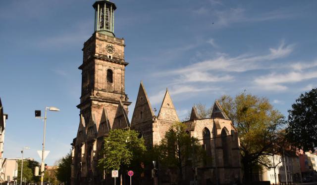
Hannover, Germany, boasts a great deal of history that is beautifully reflected in its ancient churches. A good number of them were built as far back as the 14th century. Despite the passage of time, today these architectural marvels remain largely intact, standing as a testament to Hannover's cultural and religious heritage.
One such is the Aegidia Church (Aegidienkirche). Originally... view more
Tour Duration: 1 Hour(s)
Travel Distance: 1.6 Km or 1 Miles
One such is the Aegidia Church (Aegidienkirche). Originally... view more
Tour Duration: 1 Hour(s)
Travel Distance: 1.6 Km or 1 Miles
Hanover Introduction Walking Tour
Hanover began in medieval times as a small settlement of fishermen along the River Leine. Its name, first recorded as “Honovere,” likely meant “high river bank,” referring to the slightly elevated ground that offered protection from flooding. Positioned on the North German Plain, the settlement benefited early on from both navigable river routes and overland trade paths, making it a... view more
Tour Duration: 2 Hour(s)
Travel Distance: 2.3 Km or 1.4 Miles
Tour Duration: 2 Hour(s)
Travel Distance: 2.3 Km or 1.4 Miles
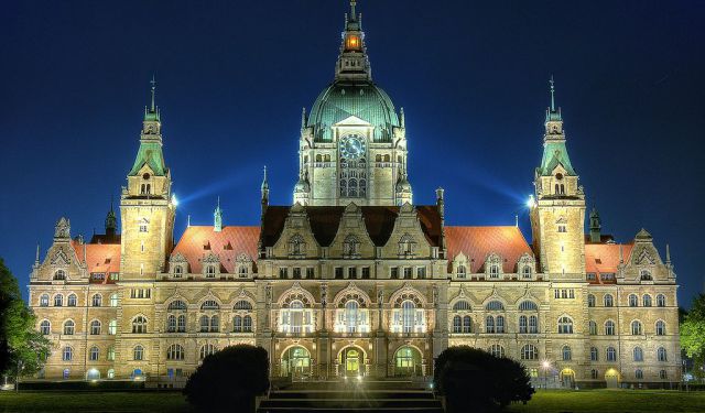
Architectural Jewels
Even though some may find Hannover rather new looking, the city in fact has a long and eventful history. As a crucial transportation hub, Hannover couldn’t escape Allied bombing during World War II; what used to be a grand city was turned into the rubble – with 90% of the local buildings destroyed. Yet, despite the bombing and ensued reconstruction, many pre-war architectural gems have... view more
Tour Duration: 1 Hour(s)
Travel Distance: 1.5 Km or 0.9 Miles
Tour Duration: 1 Hour(s)
Travel Distance: 1.5 Km or 0.9 Miles
Shopping Areas in Hannover
Hannover is ideally suited for shopping – replete with wonderful markets and elegant boutiques fit to satisfy most shoppers. All the world's top brands are packed here within easily accessible areas. Only a few cities in Germany can offer such a high density of shopping opportunities within just a few hundred meters of each other.
Subject to your interest, you can find here what you need... view more
Tour Duration: 1 Hour(s)
Travel Distance: 1.9 Km or 1.2 Miles
Subject to your interest, you can find here what you need... view more
Tour Duration: 1 Hour(s)
Travel Distance: 1.9 Km or 1.2 Miles