

Merianblick (Merian's View), Heidelberg
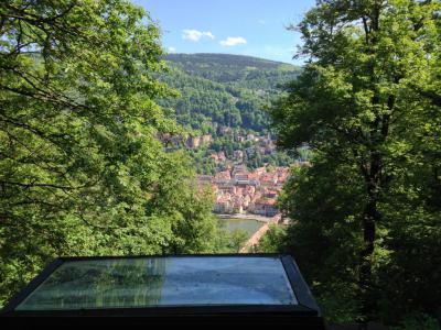
Merian’s View is one of the most historically interesting stops along Heidelberg’s Philosophers’ Path. Set high above the northern bank of the Neckar River, this sandstone viewing platform combines a broad panorama of the Old Town and Heidelberg Castle with a glimpse of how the city looked more than four centuries ago. As you stroll along the main paved trail, watch for the stone terrace set into the hillside on your right.
The viewpoint takes its name from Matthäus Merian the Elder, a Swiss-born cartographer, map maker, and publisher celebrated for his detailed topographical works. In the 1620s, Merian produced a copperplate panorama of Heidelberg showing the city shortly before it was devastated during the Thirty Years’ War, which lasted from 1618 to 1648.
A reproduction of Merian’s engraving is displayed at the viewpoint, allowing visitors to compare the historic cityscape directly with Heidelberg as it appears today. The image records the castle, fortifications, buildings, and an earlier bridge across the Neckar, preserving a valuable picture of the city before the destruction and rebuilding that transformed it during the 17th century.
For tourists, the main appeal is the unusual opportunity to compare past and present from nearly the same vantage point. Visitors can identify features that have survived, note what has changed, and enjoy excellent views over the river, Old Town, and castle. Align the lines of the copperplate reproduction on the plaque with the view across the valley, picking out the red roofs of the Old Town and the ruins of Heidelberg Castle rising directly opposite.
The viewpoint takes its name from Matthäus Merian the Elder, a Swiss-born cartographer, map maker, and publisher celebrated for his detailed topographical works. In the 1620s, Merian produced a copperplate panorama of Heidelberg showing the city shortly before it was devastated during the Thirty Years’ War, which lasted from 1618 to 1648.
A reproduction of Merian’s engraving is displayed at the viewpoint, allowing visitors to compare the historic cityscape directly with Heidelberg as it appears today. The image records the castle, fortifications, buildings, and an earlier bridge across the Neckar, preserving a valuable picture of the city before the destruction and rebuilding that transformed it during the 17th century.
For tourists, the main appeal is the unusual opportunity to compare past and present from nearly the same vantage point. Visitors can identify features that have survived, note what has changed, and enjoy excellent views over the river, Old Town, and castle. Align the lines of the copperplate reproduction on the plaque with the view across the valley, picking out the red roofs of the Old Town and the ruins of Heidelberg Castle rising directly opposite.
Want to visit this sight? Check out these Self-Guided Walking Tours in Heidelberg. Alternatively, you can download the mobile app "GPSmyCity: Walks in 1K+ Cities" from Apple App Store or Google Play Store. The app turns your mobile device to a personal tour guide and it works offline, so no data plan is needed when traveling abroad.
Download The GPSmyCity App



Merianblick (Merian's View) on Map
Sight Name: Merianblick (Merian's View)
Sight Location: Heidelberg, Germany (See walking tours in Heidelberg)
Sight Type: Attraction/Landmark
Guide(s) Containing This Sight:
Sight Location: Heidelberg, Germany (See walking tours in Heidelberg)
Sight Type: Attraction/Landmark
Guide(s) Containing This Sight:
Nearby Sights
Walking Tours in Heidelberg, Germany

Create Your Own Walk in Heidelberg
Creating your own self-guided walk in Heidelberg is easy and fun. Choose the city attractions that you want to see and a walk route map will be created just for you. You can even set your hotel as the start point of the walk.
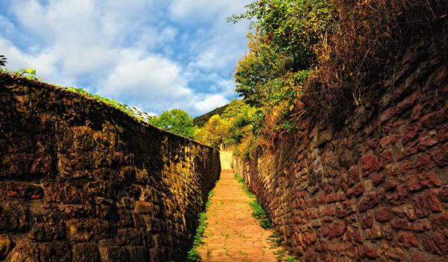
Philosophers’ Path
For generations, Heidelberg’s poets, professors, and philosophers came to this hillside to walk, talk, think, and admire the city below. Their footsteps eventually gave one of Heidelberg’s most scenic routes its name: the Philosophers’ Path.
Heidelberg may be best known for its Castle, Old Town, and historic University, but one of the city’s most rewarding experiences lies across the... view more
Tour Duration: 1 Hour(s)
Travel Distance: 1.6 Km or 1 Miles
Heidelberg may be best known for its Castle, Old Town, and historic University, but one of the city’s most rewarding experiences lies across the... view more
Tour Duration: 1 Hour(s)
Travel Distance: 1.6 Km or 1 Miles
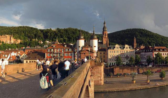
A Walk Through Heidelberg's Charming Old Town
During his European travels, American writer Mark Twain compared Heidelberg after dark to a Milky Way that had fallen to earth.
Heidelberg occupies a narrow site on the Neckar River, where the wooded Odenwald hills meet the Rhine Plain. Now Baden-Württemberg’s fifth-largest city, it has approximately 160,000 residents, around one-quarter of whom are students.
Human settlement in the... view more
Tour Duration: 2 Hour(s)
Travel Distance: 2.0 Km or 1.2 Miles
Heidelberg occupies a narrow site on the Neckar River, where the wooded Odenwald hills meet the Rhine Plain. Now Baden-Württemberg’s fifth-largest city, it has approximately 160,000 residents, around one-quarter of whom are students.
Human settlement in the... view more
Tour Duration: 2 Hour(s)
Travel Distance: 2.0 Km or 1.2 Miles