

Praia da Batata (Batata Beach), Lagos
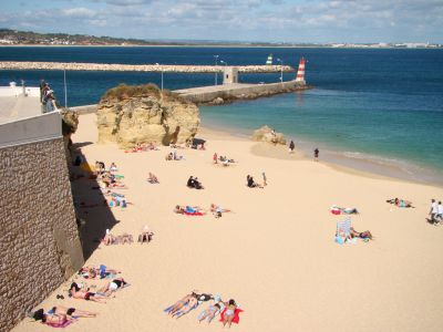
Batata Beach is one of the closest and most historically connected beaches to Lagos’ old town, located just beyond the city walls near the former harbour entrance. In earlier periods, its sheltered position made it a convenient landing place for small boats, fishermen, and coastal traffic, especially when access to the main harbour was limited or tightly controlled. During the medieval and early modern periods, the beach lay within direct sight of key fortifications, including the Governors’ Castle and Flag’s Mast Fort, which underlined its strategic importance.
After the earthquake and tsunami of 1755 reshaped the shoreline, the beach gradually lost its utilitarian role. By the 19th and 20th centuries, it was increasingly valued for its setting rather than its function.
The northern edge of the beach is divided by a long concrete pier, which originally formed the Solaria docks. While once part of the working waterfront, this area is now used for launching kayaks and small sailing boats heading along the coast toward nearby caves. Above the cliffs overlooking Batata Beach stands Mar restaurant, a popular option for a relaxed lunch, complemented by small, tasty offerings sold locally along the beach.
Today, Batata Beach is one of the most popular beaches in the city, particularly with families. Its proximity to the city centre, available amenities, and notably calm, still waters make it especially appealing. Lifeguards supervise the beach, and many locals are comfortable allowing their children to swim here unattended.
Want to visit this sight? Check out these Self-Guided Walking Tours in Lagos. Alternatively, you can download the mobile app "GPSmyCity: Walks in 1K+ Cities" from Apple App Store or Google Play Store. The app turns your mobile device to a personal tour guide and it works offline, so no data plan is needed when traveling abroad.
Download The GPSmyCity App
Praia da Batata (Batata Beach) on Map
Sight Name: Praia da Batata (Batata Beach)
Sight Location: Lagos, Portugal (See walking tours in Lagos)
Sight Type: Park/Outdoor
Guide(s) Containing This Sight:
Sight Location: Lagos, Portugal (See walking tours in Lagos)
Sight Type: Park/Outdoor
Guide(s) Containing This Sight:
Nearby Sights
Walking Tours in Lagos, Portugal

Create Your Own Walk in Lagos
Creating your own self-guided walk in Lagos is easy and fun. Choose the city attractions that you want to see and a walk route map will be created just for you. You can even set your hotel as the start point of the walk.
Lagos Introduction Walking Tour
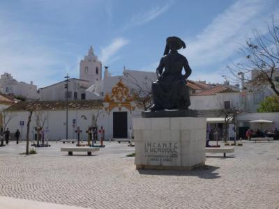
Lagos is one of the oldest towns in the Algarve, with a history shaped by its coastal position, maritime activity, and strategic value. Its name is commonly traced to the Latin Lacobriga, itself likely derived from earlier Celtic roots: lac, meaning “lake” or “lagoon,” and briga, meaning “fortified place” or “hill settlement.”
The settlement’s story stretches back over two... view more
Tour Duration: 2 Hour(s)
Travel Distance: 2.6 Km or 1.6 Miles
The settlement’s story stretches back over two... view more
Tour Duration: 2 Hour(s)
Travel Distance: 2.6 Km or 1.6 Miles
Lagos Coastline Walk
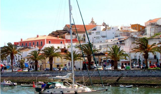
Lagos’s coastline has shaped the town’s character as much as its streets and walls, acting for centuries as both gateway and boundary. The natural harbour formed by the Bensafrim River and the chain of rocky headlands to the east created a sheltered maritime zone that defined how the town engaged with the Atlantic ocean.
For much of its history, the coastline was a working landscape. Under... view more
Tour Duration: 2 Hour(s)
Travel Distance: 3.6 Km or 2.2 Miles
For much of its history, the coastline was a working landscape. Under... view more
Tour Duration: 2 Hour(s)
Travel Distance: 3.6 Km or 2.2 Miles