

Audio Guide: Lagos Coastline Walk (Self Guided), Lagos
Lagos’s coastline has shaped the town’s character as much as its streets and walls, acting for centuries as both gateway and boundary. The natural harbour formed by the Bensafrim River and the chain of rocky headlands to the east created a sheltered maritime zone that defined how the town engaged with the Atlantic ocean.
For much of its history, the coastline was a working landscape. Under Roman rule, calm inlets and accessible beaches supported fish-salting facilities and small landing points tied directly to coastal trade. During the Islamic period, this same coast became a defensive threshold. Watchpoints were established along elevated cliffs, access points were carefully controlled, and the natural topography east of the town provided protection without the need for continuous walls.
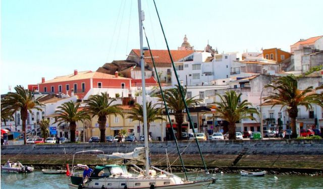
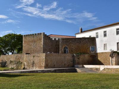
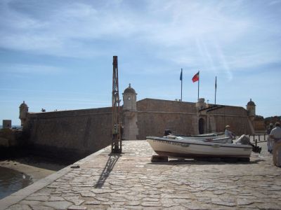
Following the Christian Reconquest, the coastline took on renewed strategic importance. Fortifications such as the Governors’ Castle and Flag’s Mast Fort were reinforced to guard the harbour entrance and regulate maritime traffic. At the same time, the Atlantic became a corridor of expansion, with Lagos positioned as a departure point for early global navigation.
The earthquake and tsunami of 1755 reshaped parts of the shoreline, damaged coastal defences, and reduced the port’s prominence. Over time, sections of the coast fell quiet, no longer central to trade or military planning.
Only in the modern period did the coastline assume its present identity. Beaches once valued for access and shelter became places of leisure. Coastal paths now trace routes that offer uninterrupted views across coves, headlands, and open sea.
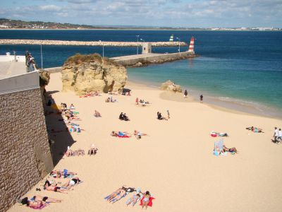
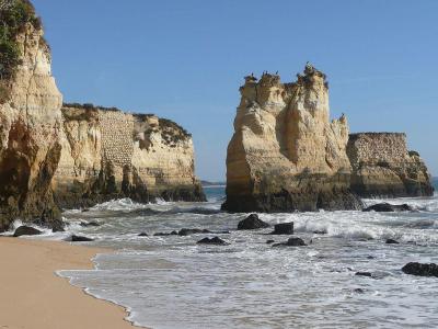
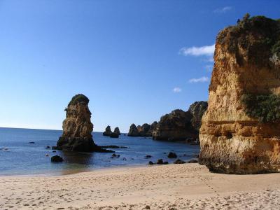
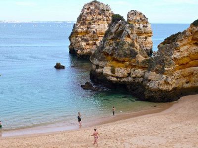
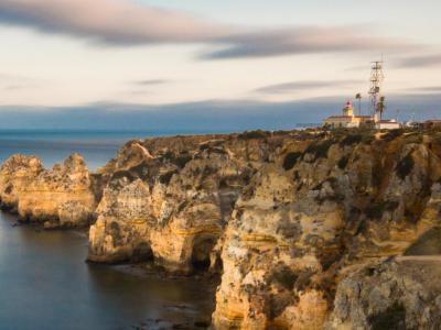
Walking along Lagos’s coastline takes you from historic defences to wide Atlantic horizons. The route passes Flag’s Mast Fort guarding the old harbour, then skirts Batata Beach, where cliffs and sand meet just beyond the city walls. Farther east, smaller coves and sculpted rock formations appear before the path reaches Ponta da Piedade, where arches, stacks, and sea-carved grottos mark the dramatic edge of the Algarve coast.
This walk invites you to follow the line where history meets the sea. With each step, the scenery shifts-from fortresses and forgotten watchpoints to open cliffs and endless water. Take your time, follow the path, and let the coastline tell its story as it unfolds around you.
For much of its history, the coastline was a working landscape. Under Roman rule, calm inlets and accessible beaches supported fish-salting facilities and small landing points tied directly to coastal trade. During the Islamic period, this same coast became a defensive threshold. Watchpoints were established along elevated cliffs, access points were carefully controlled, and the natural topography east of the town provided protection without the need for continuous walls.
Following the Christian Reconquest, the coastline took on renewed strategic importance. Fortifications such as the Governors’ Castle and Flag’s Mast Fort were reinforced to guard the harbour entrance and regulate maritime traffic. At the same time, the Atlantic became a corridor of expansion, with Lagos positioned as a departure point for early global navigation.
The earthquake and tsunami of 1755 reshaped parts of the shoreline, damaged coastal defences, and reduced the port’s prominence. Over time, sections of the coast fell quiet, no longer central to trade or military planning.
Only in the modern period did the coastline assume its present identity. Beaches once valued for access and shelter became places of leisure. Coastal paths now trace routes that offer uninterrupted views across coves, headlands, and open sea.
Walking along Lagos’s coastline takes you from historic defences to wide Atlantic horizons. The route passes Flag’s Mast Fort guarding the old harbour, then skirts Batata Beach, where cliffs and sand meet just beyond the city walls. Farther east, smaller coves and sculpted rock formations appear before the path reaches Ponta da Piedade, where arches, stacks, and sea-carved grottos mark the dramatic edge of the Algarve coast.
This walk invites you to follow the line where history meets the sea. With each step, the scenery shifts-from fortresses and forgotten watchpoints to open cliffs and endless water. Take your time, follow the path, and let the coastline tell its story as it unfolds around you.
How it works: Download the app "GPSmyCity: Walks in 1K+ Cities" from Apple App Store or Google Play Store to your mobile phone or tablet. The app turns your mobile device into a personal tour guide and its built-in GPS navigation functions guide you from one tour stop to next. The app works offline, so no data plan is needed when traveling abroad.
Download The GPSmyCity App
Lagos Coastline Walk Map
Guide Name: Lagos Coastline Walk
Guide Location: Portugal » Lagos (See other walking tours in Lagos)
Guide Type: Self-guided Walking Tour (Sightseeing)
Tour Duration: 2 Hour(s)
Travel Distance: 3.6 Km or 2.2 Miles
Guide Location: Portugal » Lagos (See other walking tours in Lagos)
Guide Type: Self-guided Walking Tour (Sightseeing)
Tour Duration: 2 Hour(s)
Travel Distance: 3.6 Km or 2.2 Miles
Sights Featured in This Walk
Walking Tours in Lagos, Portugal

Create Your Own Walk in Lagos
Creating your own self-guided walk in Lagos is easy and fun. Choose the city attractions that you want to see and a walk route map will be created just for you. You can even set your hotel as the start point of the walk.
Lagos Introduction Walking Tour
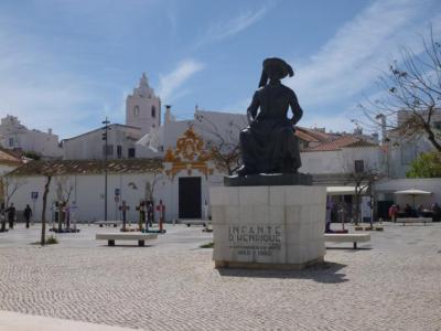
Lagos is one of the oldest towns in the Algarve, with a history shaped by its coastal position, maritime activity, and strategic value. Its name is commonly traced to the Latin Lacobriga, itself likely derived from earlier Celtic roots: lac, meaning “lake” or “lagoon,” and briga, meaning “fortified place” or “hill settlement.”
The settlement’s story stretches back over two... view more
Tour Duration: 2 Hour(s)
Travel Distance: 2.6 Km or 1.6 Miles
The settlement’s story stretches back over two... view more
Tour Duration: 2 Hour(s)
Travel Distance: 2.6 Km or 1.6 Miles
The Most Popular Cities
/ view all