

25 Martiou Street, Santorini
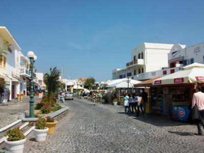
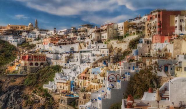
25 Martiou Street is one of the main commercial arteries of Fira, functioning as a central corridor for both daily services and visitor activity. It intersects with Theotokopoulou Square, the town’s principal civic and transport hub, where banks, pharmacies, and the bus and taxi terminals are located. This connection makes the street an essential link between public transport and the surrounding commercial and residential areas.
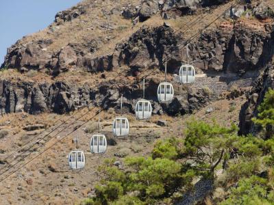
Running inland rather than along the caldera, the street connects the central square with the upper parts of town and forms part of the natural route toward Firostefani and Imerovigli settlements. Lined with jewelry shops, clothing boutiques, bakeries, travel agencies, and souvenir stores, it supports a broad mix of local needs and tourism-related commerce.
Although often described as a walking street, 25 Martiou is not fully pedestrianized year-round. It is a paved road that allows vehicle access, but car traffic is typically restricted during the summer months to manage heavy pedestrian flow. As a result, it functions in practice as one of Fira’s main walking routes, particularly for visitors moving between the transport hub and the town center.
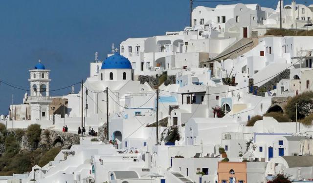
Architecturally, the street reflects the functional side of Cycladic urban life. Whitewashed facades and commercial shopfronts define its appearance, rather than continuous scenic viewpoints. While blue domes are a widely recognized symbol of Santorini, they are less characteristic here, appearing more often on nearby churches and along the caldera edge. Instead, 25 Martiou Street offers a grounded view of contemporary island life, where commerce, movement, and routine intersect at the heart of Fira.
Running inland rather than along the caldera, the street connects the central square with the upper parts of town and forms part of the natural route toward Firostefani and Imerovigli settlements. Lined with jewelry shops, clothing boutiques, bakeries, travel agencies, and souvenir stores, it supports a broad mix of local needs and tourism-related commerce.
Although often described as a walking street, 25 Martiou is not fully pedestrianized year-round. It is a paved road that allows vehicle access, but car traffic is typically restricted during the summer months to manage heavy pedestrian flow. As a result, it functions in practice as one of Fira’s main walking routes, particularly for visitors moving between the transport hub and the town center.
Architecturally, the street reflects the functional side of Cycladic urban life. Whitewashed facades and commercial shopfronts define its appearance, rather than continuous scenic viewpoints. While blue domes are a widely recognized symbol of Santorini, they are less characteristic here, appearing more often on nearby churches and along the caldera edge. Instead, 25 Martiou Street offers a grounded view of contemporary island life, where commerce, movement, and routine intersect at the heart of Fira.
Want to visit this sight? Check out these Self-Guided Walking Tours in Santorini. Alternatively, you can download the mobile app "GPSmyCity: Walks in 1K+ Cities" from Apple App Store or Google Play Store. The app turns your mobile device to a personal tour guide and it works offline, so no data plan is needed when traveling abroad.
Download The GPSmyCity App
25 Martiou Street on Map
Sight Name: 25 Martiou Street
Sight Location: Santorini, Greece (See walking tours in Santorini)
Sight Type: Attraction/Landmark
Guide(s) Containing This Sight:
Sight Location: Santorini, Greece (See walking tours in Santorini)
Sight Type: Attraction/Landmark
Guide(s) Containing This Sight:
Nearby Sights

Walking Tours in Santorini, Greece

Create Your Own Walk in Santorini
Creating your own self-guided walk in Santorini is easy and fun. Choose the city attractions that you want to see and a walk route map will be created just for you. You can even set your hotel as the start point of the walk.
Fira Walking Tour
Known in antiquity as Thera, the island was originally a roughly circular landmass shaped by volcanic activity in the southern Aegean. Its earliest known settlement dates to the Neolithic period, but Santorini entered history more clearly during the Bronze Age, when it developed into an important center of Cycladic and later Minoan civilization.
Around the 17th century BCE, Santorini... view more
Tour Duration: 2 Hour(s)
Travel Distance: 3.4 Km or 2.1 Miles
Around the 17th century BCE, Santorini... view more
Tour Duration: 2 Hour(s)
Travel Distance: 3.4 Km or 2.1 Miles

Oia Walking Tour
Oia is one of the oldest settlements on Santorini, with a history shaped by geography, seafaring, and repeated cycles of destruction and rebuilding. The village occupies the northwestern edge of the island, set along the rim of the volcanic caldera. This elevated position offered both strategic advantages and exposure to natural forces, particularly earthquakes, which have repeatedly altered the... view more
Tour Duration: 1 Hour(s)
Travel Distance: 1.0 Km or 0.6 Miles
Tour Duration: 1 Hour(s)
Travel Distance: 1.0 Km or 0.6 Miles
Firostefani and Imerovigli Walking Tour
Away from the crowded Fira yet close to the famous Santorini caldera, there are two small settlements: Firostefani and Imerovigli. Each of these gorgeous neighborhoods has something unique to offer, and thus represents an attraction in its own right.
The quaint village of Firostefani, whose name translates as "The Crown of Fira", is now considered a suburb of Santorini's capital,... view more
Tour Duration: 1 Hour(s)
Travel Distance: 2.3 Km or 1.4 Miles
The quaint village of Firostefani, whose name translates as "The Crown of Fira", is now considered a suburb of Santorini's capital,... view more
Tour Duration: 1 Hour(s)
Travel Distance: 2.3 Km or 1.4 Miles