

St. Michaelskloster (St. Michael's Monastery), Heidelberg
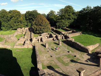
St. Michael’s Monastery stands in a forest clearing on the northern summit of the Heiligenberg. A church was established here around 870 by Thiotroch, abbot of Lorsch. In 1023, Abbot Reginbald replaced it with a larger Benedictine monastery and a three-aisled basilica. The complex later passed to Premonstratensian canons and was abandoned during the 16th century.
The ruins reveal several layers of religious history. The medieval church was built over a Roman sanctuary dedicated to Mercury, while the surrounding hill preserves traces of a large Celtic fortified settlement. Dark paving stones inside the former nave mark the Roman temple’s outline. Visitors can also identify the basilica foundations, eastern and western crypts, cloister, monks’ living quarters and the remains of two western towers. Restored sections help show how the monastery was arranged across the sloping summit.
Forest paths lead to the site, with the final approach completed on foot even when arriving near the summit by road. The open ruins can be explored freely, and the accessible tower remains provide a higher viewpoint over the monastery plan, surrounding woodland, Rhine plain and Neckar valley. Information panels explain the former rooms and the archaeological remains.
The ruins reveal several layers of religious history. The medieval church was built over a Roman sanctuary dedicated to Mercury, while the surrounding hill preserves traces of a large Celtic fortified settlement. Dark paving stones inside the former nave mark the Roman temple’s outline. Visitors can also identify the basilica foundations, eastern and western crypts, cloister, monks’ living quarters and the remains of two western towers. Restored sections help show how the monastery was arranged across the sloping summit.
Forest paths lead to the site, with the final approach completed on foot even when arriving near the summit by road. The open ruins can be explored freely, and the accessible tower remains provide a higher viewpoint over the monastery plan, surrounding woodland, Rhine plain and Neckar valley. Information panels explain the former rooms and the archaeological remains.
Want to visit this sight? Check out these Self-Guided Walking Tours in Heidelberg. Alternatively, you can download the mobile app "GPSmyCity: Walks in 1K+ Cities" from Apple App Store or Google Play Store. The app turns your mobile device to a personal tour guide and it works offline, so no data plan is needed when traveling abroad.
Download The GPSmyCity App



St. Michaelskloster (St. Michael's Monastery) on Map
Sight Name: St. Michaelskloster (St. Michael's Monastery)
Sight Location: Heidelberg, Germany (See walking tours in Heidelberg)
Sight Type: Attraction/Landmark
Sight Location: Heidelberg, Germany (See walking tours in Heidelberg)
Sight Type: Attraction/Landmark
Nearby Sights

Walking Tours in Heidelberg, Germany

Create Your Own Walk in Heidelberg
Creating your own self-guided walk in Heidelberg is easy and fun. Choose the city attractions that you want to see and a walk route map will be created just for you. You can even set your hotel as the start point of the walk.
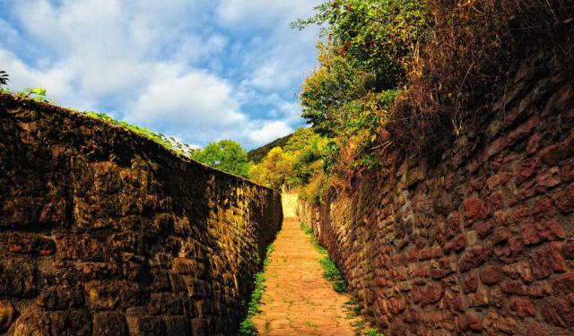
Philosophers’ Path
For generations, Heidelberg’s poets, professors, and philosophers came to this hillside to walk, talk, think, and admire the city below. Their footsteps eventually gave one of Heidelberg’s most scenic routes its name: the Philosophers’ Path.
Heidelberg may be best known for its Castle, Old Town, and historic University, but one of the city’s most rewarding experiences lies across the... view more
Tour Duration: 1 Hour(s)
Travel Distance: 1.6 Km or 1 Miles
Heidelberg may be best known for its Castle, Old Town, and historic University, but one of the city’s most rewarding experiences lies across the... view more
Tour Duration: 1 Hour(s)
Travel Distance: 1.6 Km or 1 Miles
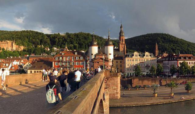
A Walk Through Heidelberg's Charming Old Town
During his European travels, American writer Mark Twain compared Heidelberg after dark to a Milky Way that had fallen to earth.
Heidelberg occupies a narrow site on the Neckar River, where the wooded Odenwald hills meet the Rhine Plain. Now Baden-Württemberg’s fifth-largest city, it has approximately 160,000 residents, around one-quarter of whom are students.
Human settlement in the... view more
Tour Duration: 2 Hour(s)
Travel Distance: 2.0 Km or 1.2 Miles
Heidelberg occupies a narrow site on the Neckar River, where the wooded Odenwald hills meet the Rhine Plain. Now Baden-Württemberg’s fifth-largest city, it has approximately 160,000 residents, around one-quarter of whom are students.
Human settlement in the... view more
Tour Duration: 2 Hour(s)
Travel Distance: 2.0 Km or 1.2 Miles