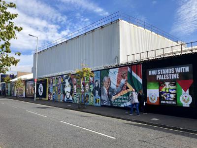


Belfast Peace Walls, Belfast (must see)
The Belfast Peace Walls are among the most striking and enduring physical reminders of the Troubles. Rather than a single structure, Belfast’s “peace walls” or “peace lines” form a network of barriers separating predominantly Catholic nationalist communities from predominantly Protestant unionist communities. The first appeared in 1969, following intense sectarian violence and rioting. Originally intended as temporary measures to reduce confrontation between neighbouring communities, simple barriers of barbed wire gradually gave way to more substantial walls of brick, concrete and steel.
The best-known section runs along Cupar Way in West Belfast, between areas around the nationalist Falls Road and unionist Shankill Road. Rising in places to around eight metres (or 25 feet), the wall provides a dramatic illustration of how physically divided Belfast became during the conflict. As you start at the western end of Cupar Way, look up at the towering grey concrete panels topped with security mesh. Gates were installed at various points to allow movement between communities, although some interface gates continue to operate on restricted schedules.
Ironically, despite their supposedly temporary nature, the barriers not only remained but increased in number over the following decades, with new structures still being erected long after the Good Friday Agreement of 1998. Various initiatives have since sought to remove the barriers, but the process has proved complicated. Although the walls symbolise division, some residents living beside them continue to regard them as providing security, illustrating the lasting impact of the Troubles on Belfast’s communities.
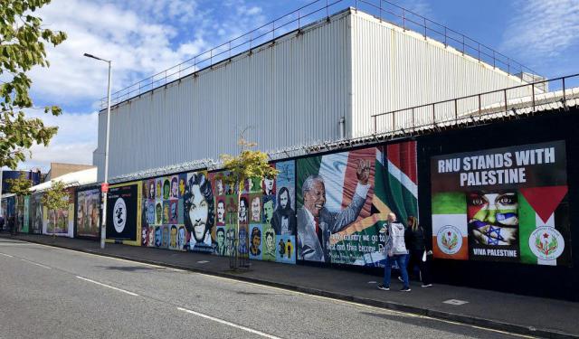
Today, the Cupar Way Peace Wall has evolved into an extraordinary open-air gallery. Graffiti and street art intermingle with colourful murals, political imagery and messages calling for peace and reconciliation. Visitors from around the world have added signatures and personal messages, transforming sections of the once purely defensive structure into a constantly changing canvas. Wherever you stop along the wall, you’re bound to find something worth examining. Pay particular attention to the layers of imagery: graffiti overlaps earlier political artwork, while handwritten messages from visitors are scattered across both.
For visitors walking between the Falls and Shankill Roads, following the Peace Wall is one of the tour’s most thought-provoking experiences. Take time to examine the artwork and messages covering its surface. Few landmarks demonstrate Belfast’s recent history quite so literally: a wall built to keep communities apart now draws people from around the world together to reflect on the meaning of peace.
The best-known section runs along Cupar Way in West Belfast, between areas around the nationalist Falls Road and unionist Shankill Road. Rising in places to around eight metres (or 25 feet), the wall provides a dramatic illustration of how physically divided Belfast became during the conflict. As you start at the western end of Cupar Way, look up at the towering grey concrete panels topped with security mesh. Gates were installed at various points to allow movement between communities, although some interface gates continue to operate on restricted schedules.
Ironically, despite their supposedly temporary nature, the barriers not only remained but increased in number over the following decades, with new structures still being erected long after the Good Friday Agreement of 1998. Various initiatives have since sought to remove the barriers, but the process has proved complicated. Although the walls symbolise division, some residents living beside them continue to regard them as providing security, illustrating the lasting impact of the Troubles on Belfast’s communities.
Today, the Cupar Way Peace Wall has evolved into an extraordinary open-air gallery. Graffiti and street art intermingle with colourful murals, political imagery and messages calling for peace and reconciliation. Visitors from around the world have added signatures and personal messages, transforming sections of the once purely defensive structure into a constantly changing canvas. Wherever you stop along the wall, you’re bound to find something worth examining. Pay particular attention to the layers of imagery: graffiti overlaps earlier political artwork, while handwritten messages from visitors are scattered across both.
For visitors walking between the Falls and Shankill Roads, following the Peace Wall is one of the tour’s most thought-provoking experiences. Take time to examine the artwork and messages covering its surface. Few landmarks demonstrate Belfast’s recent history quite so literally: a wall built to keep communities apart now draws people from around the world together to reflect on the meaning of peace.
Want to visit this sight? Check out these Self-Guided Walking Tours in Belfast. Alternatively, you can download the mobile app "GPSmyCity: Walks in 1K+ Cities" from Apple App Store or Google Play Store. The app turns your mobile device to a personal tour guide and it works offline, so no data plan is needed when traveling abroad.
Download The GPSmyCity App



Belfast Peace Walls on Map
Sight Name: Belfast Peace Walls
Sight Location: Belfast, Ireland (See walking tours in Belfast)
Sight Type: Attraction/Landmark
Guide(s) Containing This Sight:
Sight Location: Belfast, Ireland (See walking tours in Belfast)
Sight Type: Attraction/Landmark
Guide(s) Containing This Sight:
Nearby Sights
Walking Tours in Belfast, Ireland
Create Your Own Walk in Belfast
Creating your own self-guided walk in Belfast is easy and fun. Choose the city attractions that you want to see and a walk route map will be created just for you. You can even set your hotel as the start point of the walk.
The Troubles and Peace Process Landmarks
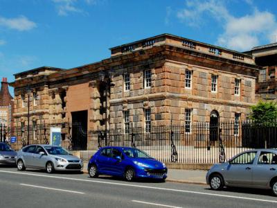
For almost three decades, Belfast was at the centre of the Troubles, a conflict that profoundly shaped Northern Ireland and left lasting marks on the city. Although its roots stretch much further back, the Troubles are generally dated from the late 1960s to the Good Friday Agreement of 1998.
At the heart of the conflict were competing visions of Northern Ireland’s future. Unionists and... view more
Tour Duration: 1 Hour(s)
Travel Distance: 2.1 Km or 1.3 Miles
At the heart of the conflict were competing visions of Northern Ireland’s future. Unionists and... view more
Tour Duration: 1 Hour(s)
Travel Distance: 2.1 Km or 1.3 Miles
Belfast Introduction Walking Tour
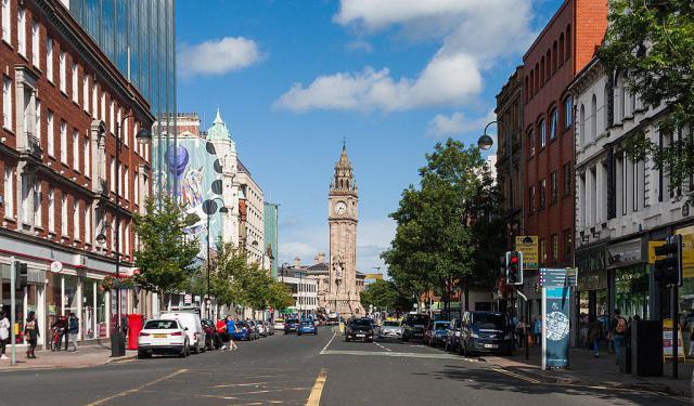
For over a century, the political situation of Belfast, the capital of Northern Ireland, has been the source of strife, first between the Crown-loyal Protestants and Irish Catholics, and more recently between the United Kingdom and the European Union.
Sitting on the banks of the River Lagan where it meets the Irish Sea, the city owes its name to this coastal condition, with "Belfast"... view more
Tour Duration: 2 Hour(s)
Travel Distance: 3.8 Km or 2.4 Miles
Sitting on the banks of the River Lagan where it meets the Irish Sea, the city owes its name to this coastal condition, with "Belfast"... view more
Tour Duration: 2 Hour(s)
Travel Distance: 3.8 Km or 2.4 Miles
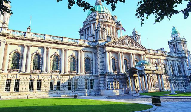
Belfast Victorian Architecture Jewels
Described as “modestly scaled, undemonstrative, somewhat solid in aspect, and usually restrained (sometimes even austere) in its use of external decoration”, the urban landscape of Belfast has been influenced by the demands of shipbuilding and linen industry, much as transitioning between culture, arts, commerce, and education. Still, the architectural spectrum of the city is quite broad and... view more
Tour Duration: 2 Hour(s)
Travel Distance: 2.9 Km or 1.8 Miles
Tour Duration: 2 Hour(s)
Travel Distance: 2.9 Km or 1.8 Miles