

The Troubles and Peace Process Landmarks (Self Guided), Belfast
For almost three decades, Belfast was at the centre of the Troubles, a conflict that profoundly shaped Northern Ireland and left lasting marks on the city. Although its roots stretch much further back, the Troubles are generally dated from the late 1960s to the Good Friday Agreement of 1998.
At the heart of the conflict were competing visions of Northern Ireland’s future. Unionists and loyalists, predominantly Protestant, generally wanted Northern Ireland to remain part of the United Kingdom, while nationalists and republicans, predominantly Catholic, sought a united Ireland. Political disputes were compounded by discrimination, segregation and inequalities in areas such as housing, employment and political representation.
In August 1969, serious rioting erupted in Belfast, particularly around the neighbouring Falls and Shankill districts. British troops were deployed to Northern Ireland, initially with the aim of restoring order. What followed was an increasingly violent conflict involving republican paramilitary organisations, loyalist groups and British security forces. Bombings, shootings and assassinations became grim features of everyday life. More than 3,500 people were killed during the Troubles across Northern Ireland and beyond.
Belfast became deeply segregated. Beginning in 1969, barriers known as peace lines or peace walls were erected between some Catholic and Protestant neighbourhoods. Initially intended as temporary measures, many remained long after the violence subsided.
By the early 1990s, political negotiations were gathering momentum. Republican and loyalist paramilitaries announced major ceasefires in 1994, paving the way for multi-party talks chaired by American senator George Mitchell. Years of difficult negotiations culminated in the Good Friday Agreement, signed on 10 April 1998. The agreement established power-sharing institutions, recognised the right of people in Northern Ireland to identify as British, Irish or both, and confirmed that Northern Ireland’s constitutional status could change only with the consent of its people.
The violence greatly diminished, but its physical and emotional legacy remains visible. Today, Belfast’s murals, memorial gardens and peace walls tell stories of loss, identity, political struggle and reconciliation.
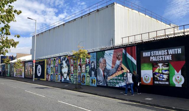
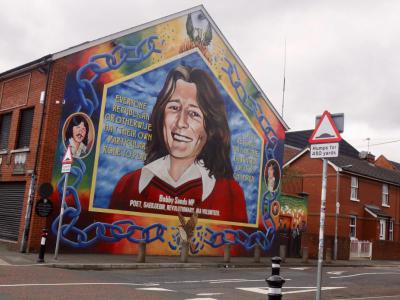
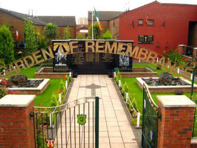
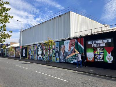
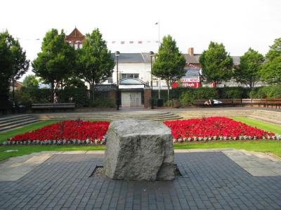
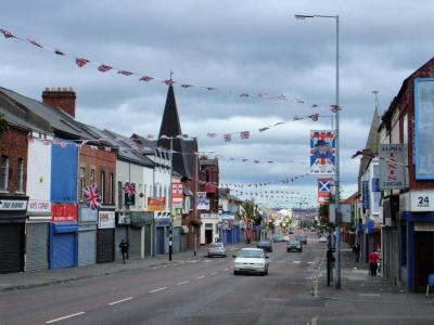
Walking through West Belfast reveals some of the most powerful reminders of the Troubles. Along the predominantly nationalist Falls Road, you’ll encounter the famous Bobby Sands Mural, the Irish Republican History Museum and republican memorials before reaching the towering Peace Wall, separating historically Catholic and Protestant communities. Crossing towards the predominantly unionist Shankill Road, murals and flags present another perspective on the city’s history, while the Shankill Road Memorial Gardens commemorate the victims of the devastating 1993 bombing.
As you move from the Falls to the Shankill, look beyond the murals and memorials to the stories they preserve. Belfast’s walls were built to divide, but today they can also help us understand just how difficult—and remarkable—the journey towards peace has been.
At the heart of the conflict were competing visions of Northern Ireland’s future. Unionists and loyalists, predominantly Protestant, generally wanted Northern Ireland to remain part of the United Kingdom, while nationalists and republicans, predominantly Catholic, sought a united Ireland. Political disputes were compounded by discrimination, segregation and inequalities in areas such as housing, employment and political representation.
In August 1969, serious rioting erupted in Belfast, particularly around the neighbouring Falls and Shankill districts. British troops were deployed to Northern Ireland, initially with the aim of restoring order. What followed was an increasingly violent conflict involving republican paramilitary organisations, loyalist groups and British security forces. Bombings, shootings and assassinations became grim features of everyday life. More than 3,500 people were killed during the Troubles across Northern Ireland and beyond.
Belfast became deeply segregated. Beginning in 1969, barriers known as peace lines or peace walls were erected between some Catholic and Protestant neighbourhoods. Initially intended as temporary measures, many remained long after the violence subsided.
By the early 1990s, political negotiations were gathering momentum. Republican and loyalist paramilitaries announced major ceasefires in 1994, paving the way for multi-party talks chaired by American senator George Mitchell. Years of difficult negotiations culminated in the Good Friday Agreement, signed on 10 April 1998. The agreement established power-sharing institutions, recognised the right of people in Northern Ireland to identify as British, Irish or both, and confirmed that Northern Ireland’s constitutional status could change only with the consent of its people.
The violence greatly diminished, but its physical and emotional legacy remains visible. Today, Belfast’s murals, memorial gardens and peace walls tell stories of loss, identity, political struggle and reconciliation.
Walking through West Belfast reveals some of the most powerful reminders of the Troubles. Along the predominantly nationalist Falls Road, you’ll encounter the famous Bobby Sands Mural, the Irish Republican History Museum and republican memorials before reaching the towering Peace Wall, separating historically Catholic and Protestant communities. Crossing towards the predominantly unionist Shankill Road, murals and flags present another perspective on the city’s history, while the Shankill Road Memorial Gardens commemorate the victims of the devastating 1993 bombing.
As you move from the Falls to the Shankill, look beyond the murals and memorials to the stories they preserve. Belfast’s walls were built to divide, but today they can also help us understand just how difficult—and remarkable—the journey towards peace has been.
How it works: Download the app "GPSmyCity: Walks in 1K+ Cities" from Apple App Store or Google Play Store to your mobile phone or tablet. The app turns your mobile device into a personal tour guide and its built-in GPS navigation functions guide you from one tour stop to next. The app works offline, so no data plan is needed when traveling abroad.
Download The GPSmyCity App



The Troubles and Peace Process Landmarks Map
Guide Name: The Troubles and Peace Process Landmarks
Guide Location: Ireland » Belfast (See other walking tours in Belfast)
Guide Type: Self-guided Walking Tour (Sightseeing)
Tour Duration: 1 Hour(s)
Travel Distance: 2.1 Km or 1.3 Miles
Guide Location: Ireland » Belfast (See other walking tours in Belfast)
Guide Type: Self-guided Walking Tour (Sightseeing)
Tour Duration: 1 Hour(s)
Travel Distance: 2.1 Km or 1.3 Miles
Sights Featured in This Walk
Walking Tours in Belfast, Ireland
Create Your Own Walk in Belfast
Creating your own self-guided walk in Belfast is easy and fun. Choose the city attractions that you want to see and a walk route map will be created just for you. You can even set your hotel as the start point of the walk.
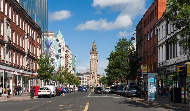
Belfast Introduction Walking Tour
For over a century, the political situation of Belfast, the capital of Northern Ireland, has been the source of strife, first between the Crown-loyal Protestants and Irish Catholics, and more recently between the United Kingdom and the European Union.
Sitting on the banks of the River Lagan where it meets the Irish Sea, the city owes its name to this coastal condition, with "Belfast"... view more
Tour Duration: 2 Hour(s)
Travel Distance: 3.8 Km or 2.4 Miles
Sitting on the banks of the River Lagan where it meets the Irish Sea, the city owes its name to this coastal condition, with "Belfast"... view more
Tour Duration: 2 Hour(s)
Travel Distance: 3.8 Km or 2.4 Miles
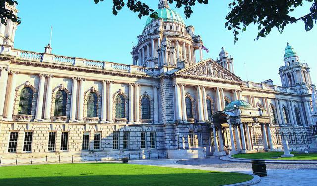
Belfast Victorian Architecture Jewels
Described as “modestly scaled, undemonstrative, somewhat solid in aspect, and usually restrained (sometimes even austere) in its use of external decoration”, the urban landscape of Belfast has been influenced by the demands of shipbuilding and linen industry, much as transitioning between culture, arts, commerce, and education. Still, the architectural spectrum of the city is quite broad and... view more
Tour Duration: 2 Hour(s)
Travel Distance: 2.9 Km or 1.8 Miles
Tour Duration: 2 Hour(s)
Travel Distance: 2.9 Km or 1.8 Miles
The Most Popular Cities
/ view all