

Tirana Introduction Walking Tour (Self Guided), Tirana
In Tirana, even apartment blocks were once given a public mission. Under artist-turned-mayor Edi Rama, gray façades from the communist years were painted in bold colors, turning ordinary streets into a visible sign of recovery after the long isolation.
Tirana, the capital of Albania, has a history shaped by crossroads, empire, isolation, and rapid reinvention. Although the wider area was inhabited long before the modern city appeared, Tirana itself began to take clearer urban form in the early 17th century. In 1614, the Ottoman general Sulejman Pasha Bargjini is traditionally credited with founding the settlement, building a mosque, a bakery, and a bath house. These basic institutions helped turn a modest stop along regional trade routes into a small market town.
The origin of the name “Tirana” is debated. One common explanation links it to earlier Illyrian or Roman-era place names in the region. Another theory associates it with the Greek word tyros, meaning “cheese,” suggesting a link to pastoral life.
For much of the Ottoman period, Tirana remained a modest provincial town, known for its bazaar, mosques, craft workshops, and surrounding agricultural land. Its importance grew slowly in the 18th and 19th centuries, helped by its position near routes connecting central Albania with the coast and the interior. After Albania declared independence in 1912, the country’s new state institutions needed a permanent center. In 1920, Tirana was chosen as Albania’s capital, partly because of its central location and partly because it was not as closely tied to rival regional power bases as some older cities.
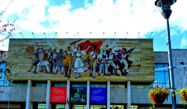
During the reign of King Zog in the 1920s and 1930s, Tirana began to acquire the appearance of a planned capital. Italian architects and planners helped shape broad boulevards, government buildings, and public squares. After World War II, Albania became a communist state, and Tirana was transformed again: monumental buildings, housing blocks, factories, and propaganda-filled public spaces.
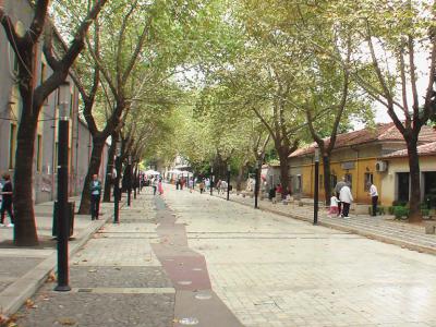
Since the fall of communism in the early 1990s, Tirana has changed dramatically. Once marked by gray concrete and political rigidity, it has become Albania’s most dynamic urban center, known for colorful buildings, busy cafés, cultural institutions, and constant construction.
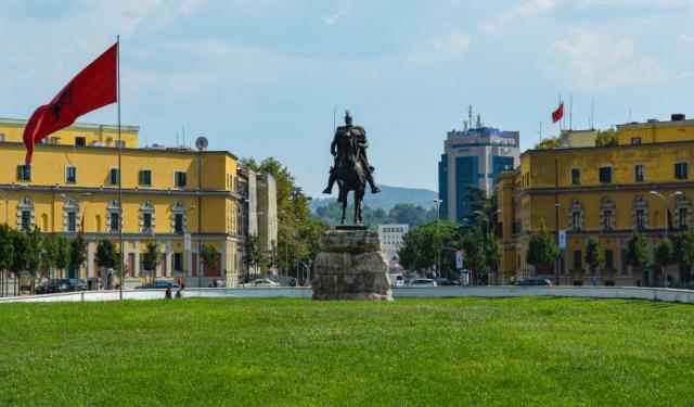
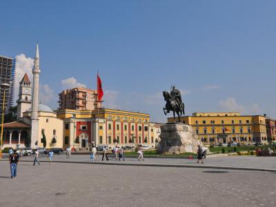
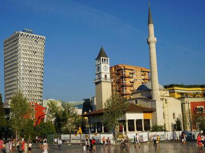
Walking through the center, visitors will see a compact mix of eras gathered around Skanderbeg Square. The Et’hem Bey Mosque, Clock Tower and National History Museum frame the city’s symbolic heart. Nearby, broad boulevards, painted apartment blocks, cafés, shops, and public art show Tirana’s newer energy.
Tirana may not wear its history quietly, but that is part of its character. Here, the past appears in Ottoman landmarks, Italian-planned boulevards, communist-era blocks, and buildings repainted for a new age.
Tirana, the capital of Albania, has a history shaped by crossroads, empire, isolation, and rapid reinvention. Although the wider area was inhabited long before the modern city appeared, Tirana itself began to take clearer urban form in the early 17th century. In 1614, the Ottoman general Sulejman Pasha Bargjini is traditionally credited with founding the settlement, building a mosque, a bakery, and a bath house. These basic institutions helped turn a modest stop along regional trade routes into a small market town.
The origin of the name “Tirana” is debated. One common explanation links it to earlier Illyrian or Roman-era place names in the region. Another theory associates it with the Greek word tyros, meaning “cheese,” suggesting a link to pastoral life.
For much of the Ottoman period, Tirana remained a modest provincial town, known for its bazaar, mosques, craft workshops, and surrounding agricultural land. Its importance grew slowly in the 18th and 19th centuries, helped by its position near routes connecting central Albania with the coast and the interior. After Albania declared independence in 1912, the country’s new state institutions needed a permanent center. In 1920, Tirana was chosen as Albania’s capital, partly because of its central location and partly because it was not as closely tied to rival regional power bases as some older cities.
During the reign of King Zog in the 1920s and 1930s, Tirana began to acquire the appearance of a planned capital. Italian architects and planners helped shape broad boulevards, government buildings, and public squares. After World War II, Albania became a communist state, and Tirana was transformed again: monumental buildings, housing blocks, factories, and propaganda-filled public spaces.
Since the fall of communism in the early 1990s, Tirana has changed dramatically. Once marked by gray concrete and political rigidity, it has become Albania’s most dynamic urban center, known for colorful buildings, busy cafés, cultural institutions, and constant construction.
Walking through the center, visitors will see a compact mix of eras gathered around Skanderbeg Square. The Et’hem Bey Mosque, Clock Tower and National History Museum frame the city’s symbolic heart. Nearby, broad boulevards, painted apartment blocks, cafés, shops, and public art show Tirana’s newer energy.
Tirana may not wear its history quietly, but that is part of its character. Here, the past appears in Ottoman landmarks, Italian-planned boulevards, communist-era blocks, and buildings repainted for a new age.
How it works: Download the app "GPSmyCity: Walks in 1K+ Cities" from Apple App Store or Google Play Store to your mobile phone or tablet. The app turns your mobile device into a personal tour guide. For US$14.99 per year (with a 3-day free trial), you get access to walking tours in 630+ cities worldwide for an entire year. In comparison, a guided tour often costs dozens of dollars per person for a single tour. The app works offline, so no data plan is needed when traveling abroad.
Download The GPSmyCity App
Tirana Introduction Walking Tour Map
Guide Name: Tirana Introduction Walking Tour
Guide Location: Albania » Tirana (See other walking tours in Tirana)
Guide Type: Self-guided Walking Tour (Sightseeing)
Tour Duration: 1 Hour(s)
Travel Distance: 0.9 Km or 0.6 Miles
Guide Location: Albania » Tirana (See other walking tours in Tirana)
Guide Type: Self-guided Walking Tour (Sightseeing)
Tour Duration: 1 Hour(s)
Travel Distance: 0.9 Km or 0.6 Miles
Sights Featured in This Walk


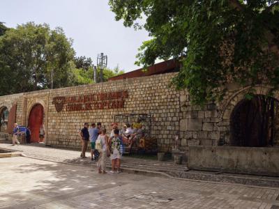
6) BunkArt 2 (must see)
Walking Tours in Tirana, Albania

Create Your Own Walk in Tirana
Creating your own self-guided walk in Tirana is easy and fun. Choose the city attractions that you want to see and a walk route map will be created just for you. You can even set your hotel as the start point of the walk.
Communist Heritage Sites
The people of Albania lived in a Communist state from 1976 through 1992. The country was ruled by one party, the Party of Labor of Albania. Dictator Enver Hoxha held power over the country and established a Stalinist-style of administration.
Citizens were oppressed by the secret police, known as the Sigurimi. They would spy on anyone who they believed to be an enemy of the state. Those who were... view more
Tour Duration: 1 Hour(s)
Travel Distance: 1.8 Km or 1.1 Miles
Citizens were oppressed by the secret police, known as the Sigurimi. They would spy on anyone who they believed to be an enemy of the state. Those who were... view more
Tour Duration: 1 Hour(s)
Travel Distance: 1.8 Km or 1.1 Miles
The Most Popular Cities
/ view all