

Audio Guide: Castries Introduction Walking Tour (Self Guided), Castries
Nobel Prize-winning poet and playwright Derek Walcott could have easily moved on from his home country, both physically and spiritually. His famous line, "The sea is history" proves otherwise. He felt a deep bond with the sea that once "cradled" him.
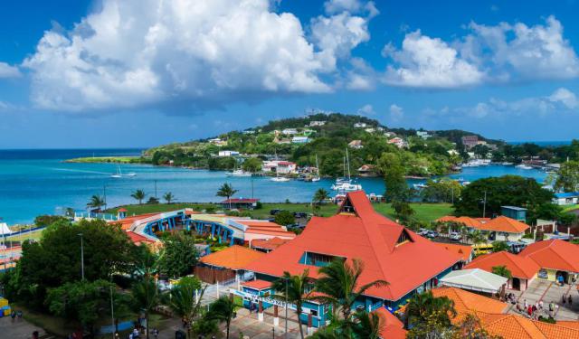
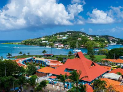
Castries, the capital of Saint Lucia, stretches along a wide, sheltered bay on the island’s northwest coast. Its name pays tribute to Charles de Castries, the French Minister of the Navy and Colonies in the late 18th century. In 1785 the French officially renamed the growing settlement “Castries,” reflecting both his influence and France’s desire to strengthen its Caribbean foothold.
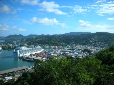
Long before European ships entered the bay, the island was home to the Arawak and later the Kalinago peoples. The French first claimed Saint Lucia in 1650, establishing a settlement named Carenage near present-day Castries. The island soon became one of the most fiercely contested territories in the Caribbean. Between the 17th and 19th centuries, France and Britain fought for control no fewer than fourteen times, earning Saint Lucia the nickname “Helen of the West Indies.” Castries, with its deep natural harbor, lay at the center of this long struggle.
In 1769 Governor de Micoud undertook the formal development of the town, reclaiming mangrove swampland and laying out a street grid that still shapes the historic center. When Britain secured permanent control in 1814 under the Treaty of Paris, Castries evolved into a major colonial port and coaling station for transatlantic steamships. Its deep bay made it an essential naval stopover for the Royal Navy, while the island’s sugar economy fed commercial growth. The surrounding hills-including Morne Fortuné -were fortified to protect the harbor from rival powers.
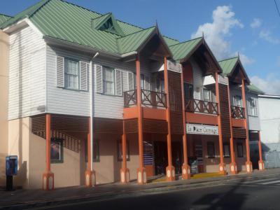
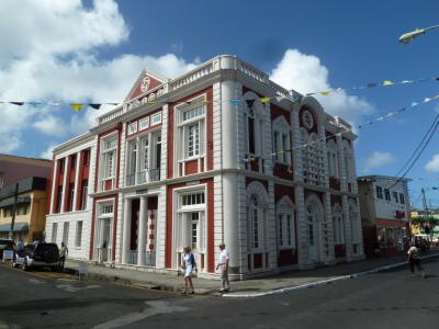
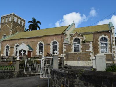
Castries’ appearance has changed dramatically over time, shaped by conflict, disaster, and rebuilding. A devastating fire in 1813 destroyed much of the early town, and the Great Fire of 1948 obliterated nearly 80 percent of its buildings. Postwar reconstruction introduced modern concrete architecture and wider streets, giving Castries much of its present-day character. Only a few colonial-era structures survived the blaze.
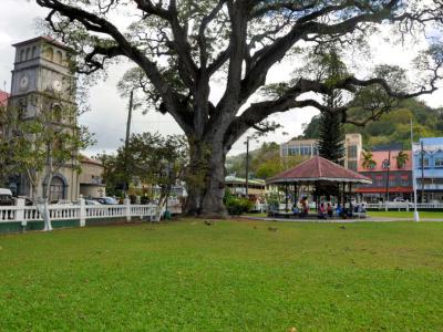
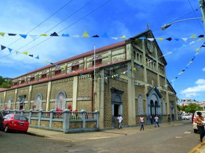
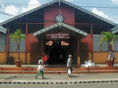
A walk through Castries reveals a lively Caribbean capital filled with color and movement. Visitors encounter the bustling Castries Market with its spices and crafts, the landmark Cathedral Basilica with its painted interior, and Derek Walcott Square shaded by centuries-old trees. Along the waterfront, the busy harbor frames views of ships and fishing boats, while nearby streets offer boutiques, murals, and the rhythm of island life unfolding in restaurants and open-air stalls.
As your walk comes to an end, return to the shoreline. In its shifting reflections, you may find what Derek Walcott understood so well: here, the sea doesn’t just shape the city’s story - it is the story.
Castries, the capital of Saint Lucia, stretches along a wide, sheltered bay on the island’s northwest coast. Its name pays tribute to Charles de Castries, the French Minister of the Navy and Colonies in the late 18th century. In 1785 the French officially renamed the growing settlement “Castries,” reflecting both his influence and France’s desire to strengthen its Caribbean foothold.
Long before European ships entered the bay, the island was home to the Arawak and later the Kalinago peoples. The French first claimed Saint Lucia in 1650, establishing a settlement named Carenage near present-day Castries. The island soon became one of the most fiercely contested territories in the Caribbean. Between the 17th and 19th centuries, France and Britain fought for control no fewer than fourteen times, earning Saint Lucia the nickname “Helen of the West Indies.” Castries, with its deep natural harbor, lay at the center of this long struggle.
In 1769 Governor de Micoud undertook the formal development of the town, reclaiming mangrove swampland and laying out a street grid that still shapes the historic center. When Britain secured permanent control in 1814 under the Treaty of Paris, Castries evolved into a major colonial port and coaling station for transatlantic steamships. Its deep bay made it an essential naval stopover for the Royal Navy, while the island’s sugar economy fed commercial growth. The surrounding hills-including Morne Fortuné -were fortified to protect the harbor from rival powers.
Castries’ appearance has changed dramatically over time, shaped by conflict, disaster, and rebuilding. A devastating fire in 1813 destroyed much of the early town, and the Great Fire of 1948 obliterated nearly 80 percent of its buildings. Postwar reconstruction introduced modern concrete architecture and wider streets, giving Castries much of its present-day character. Only a few colonial-era structures survived the blaze.
A walk through Castries reveals a lively Caribbean capital filled with color and movement. Visitors encounter the bustling Castries Market with its spices and crafts, the landmark Cathedral Basilica with its painted interior, and Derek Walcott Square shaded by centuries-old trees. Along the waterfront, the busy harbor frames views of ships and fishing boats, while nearby streets offer boutiques, murals, and the rhythm of island life unfolding in restaurants and open-air stalls.
As your walk comes to an end, return to the shoreline. In its shifting reflections, you may find what Derek Walcott understood so well: here, the sea doesn’t just shape the city’s story - it is the story.
How it works: Download the app "GPSmyCity: Walks in 1K+ Cities" from Apple App Store or Google Play Store to your mobile phone or tablet. The app turns your mobile device into a personal tour guide and its built-in GPS navigation functions guide you from one tour stop to next. The app works offline, so no data plan is needed when traveling abroad.
Download The GPSmyCity App
Castries Introduction Walking Tour Map
Guide Name: Castries Introduction Walking Tour
Guide Location: St Lucia » Castries (See other walking tours in Castries)
Guide Type: Self-guided Walking Tour (Sightseeing)
Tour Duration: 2 Hour(s)
Travel Distance: 2.7 Km or 1.7 Miles
Guide Location: St Lucia » Castries (See other walking tours in Castries)
Guide Type: Self-guided Walking Tour (Sightseeing)
Tour Duration: 2 Hour(s)
Travel Distance: 2.7 Km or 1.7 Miles
Sights Featured in This Walk
The Most Popular Cities
/ view all