

Ensenada Introduction Walking Tour (Self Guided), Ensenada
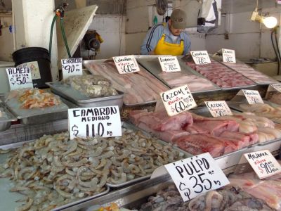
When Franciscan missionary Junípero Serra passed through in 1769, he painted early Ensenada as a place of ‘immense gentility,’ where people lived ‘very leisurely’-fishing from reed rafts in the calm bay. This core identity is still there, centuries later. The name Ensenada means “cove” or “bay” in Spanish, a direct reference to its natural harbor. Long before Spanish sails appeared on the horizon, the Kumiay and Pai Pai peoples were already thriving here-fishing, hunting, gathering, and trading with inland neighbors, guided by a deep connection to sea and land.
Spanish exploration of the Western American coast began in the 16th century, but it was not until the 17th and 18th centuries that missionaries and settlers began establishing permanent outposts. In 1703, the Jesuits founded the Mission of San Francisco de Borja not far from Ensenada, and later the Dominicans established additional missions nearby. It was not until after Mexico’s independence from Spain in 1821 that Ensenada began to take shape as a small but strategic community.
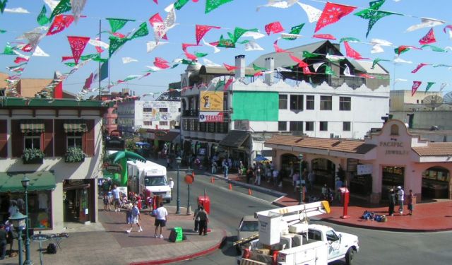
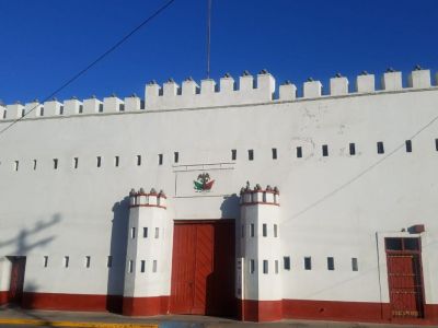
The natural bay gave it importance as a harbor, attracting merchants, whalers, and later settlers. In 1882, the Mexican government designated it as the capital of Baja California Territory, a role it held until 1915 when the capital shifted to Mexicali. Administrative buildings, streets, and commercial activity expanded, laying the framework of the modern city.
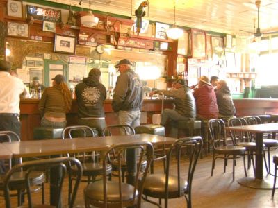
The years that followed brought dramatic change. In the 1920s and ’30s, when the United States went dry under Prohibition, American entrepreneurs flowed south. Baja’s coast turned into a hotspot for tourism, gambling and alcohol. Ensenada was right at the center of it. Though the boom was short-lived, it left a mark on the city’s reputation as a leisure destination.
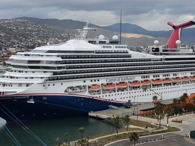
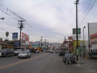
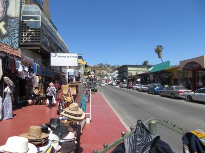
The city kept evolving. Agriculture and fishing kept people working, but it was the wine industry in the nearby Guadalupe Valley that gave Ensenada international flavor. The city also developed into a scientific hub, hosting institutions such as the Ensenada Center for Scientific Research and Higher Education. Its deep-water port has played a key role in commerce and tourism. The Port of Ensenada turned into a vital stop for both cargo and passenger ships, and today it continues as one of Mexico’s busiest Pacific ports, welcoming cruise liners alongside commercial vessels.
What Serra once called a place of 'immense gentility' remains so, though expressed differently now-in the easy conversations of fishermen, the lively exchanges at the market, and the quiet endurance of old civic buildings. Let that rhythm carry you forward into the story of Baja California.
Spanish exploration of the Western American coast began in the 16th century, but it was not until the 17th and 18th centuries that missionaries and settlers began establishing permanent outposts. In 1703, the Jesuits founded the Mission of San Francisco de Borja not far from Ensenada, and later the Dominicans established additional missions nearby. It was not until after Mexico’s independence from Spain in 1821 that Ensenada began to take shape as a small but strategic community.
The natural bay gave it importance as a harbor, attracting merchants, whalers, and later settlers. In 1882, the Mexican government designated it as the capital of Baja California Territory, a role it held until 1915 when the capital shifted to Mexicali. Administrative buildings, streets, and commercial activity expanded, laying the framework of the modern city.
The years that followed brought dramatic change. In the 1920s and ’30s, when the United States went dry under Prohibition, American entrepreneurs flowed south. Baja’s coast turned into a hotspot for tourism, gambling and alcohol. Ensenada was right at the center of it. Though the boom was short-lived, it left a mark on the city’s reputation as a leisure destination.
The city kept evolving. Agriculture and fishing kept people working, but it was the wine industry in the nearby Guadalupe Valley that gave Ensenada international flavor. The city also developed into a scientific hub, hosting institutions such as the Ensenada Center for Scientific Research and Higher Education. Its deep-water port has played a key role in commerce and tourism. The Port of Ensenada turned into a vital stop for both cargo and passenger ships, and today it continues as one of Mexico’s busiest Pacific ports, welcoming cruise liners alongside commercial vessels.
What Serra once called a place of 'immense gentility' remains so, though expressed differently now-in the easy conversations of fishermen, the lively exchanges at the market, and the quiet endurance of old civic buildings. Let that rhythm carry you forward into the story of Baja California.
How it works: Download the app "GPSmyCity: Walks in 1K+ Cities" from Apple App Store or Google Play Store to your mobile phone or tablet. The app turns your mobile device into a personal tour guide and its built-in GPS navigation functions guide you from one tour stop to next. The app works offline, so no data plan is needed when traveling abroad.
Download The GPSmyCity App
Ensenada Introduction Walking Tour Map
Guide Name: Ensenada Introduction Walking Tour
Guide Location: Mexico » Ensenada (See other walking tours in Ensenada)
Guide Type: Self-guided Walking Tour (Sightseeing)
Tour Duration: 2 Hour(s)
Travel Distance: 3.8 Km or 2.4 Miles
Guide Location: Mexico » Ensenada (See other walking tours in Ensenada)
Guide Type: Self-guided Walking Tour (Sightseeing)
Tour Duration: 2 Hour(s)
Travel Distance: 3.8 Km or 2.4 Miles
Sights Featured in This Walk
The Most Popular Cities
/ view all