

Miltenberg Introduction Walking Tour (Self Guided), Miltenberg
Not even the small towns were safe from the wrath of the Nazis. Following the mass deportation of the Jewish population, the cobblestones of Miltenberg became dotted with brass Stolpersteine-stumbling stones-courtesy of artist Gunter Demnig.
Miltenberg’s name comes from the castle above the town-Mildenburg-from which the settlement below took its name.
Long before the Middle Ages, the area around Miltenberg was already inhabited. Prehistoric ring walls on local hills testify to early settlement. During Roman times, Miltenberg lay near the empire’s outer frontier; its riverside position made it a strategic point. When the Romans withdrew in the 3rd century AD, the region faced incursions by the Alemanni and other tribes, and settlement patterns shifted.
In the early Middle Ages, the area came under Frankish control, and new settlements formed near the old Roman defenses. A Carolingian church may have stood by the 9th century, built using stones from earlier Roman structures. The medieval core of Miltenberg developed around a toll station on the Main River, protected by the castle above. The town benefited from a clever economic policy-a medieval trading privilege requiring passing merchants to display or store their goods locally for a period-which spurred commerce, warehousing, and the growth of inns.
By 1237, Miltenberg was recognized as a town, complete with walls, gates, and towers. It remained under the influence of the Archbishopric of Mainz for many centuries, a connection that shaped much of its political and cultural life. Throughout its history, Miltenberg weathered numerous conflicts: it was affected by the German Peasants’ War in 1525, and parts of the town were burned in 1552. During the Thirty Years’ War in the 17th century, war and plague decimated the population.
In the Napoleonic era, Miltenberg’s status shifted again. Until 1803, it belonged to Electoral Mainz. Over the next decade, it changed hands between duchies before finally joining the Kingdom of Bavaria in 1816.
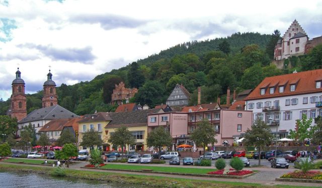
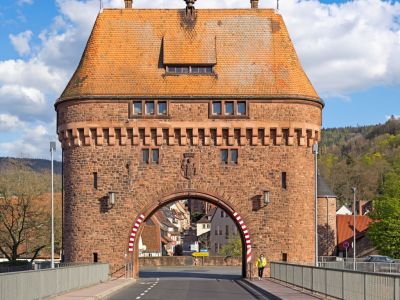
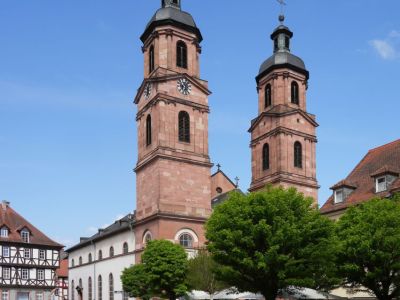
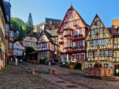
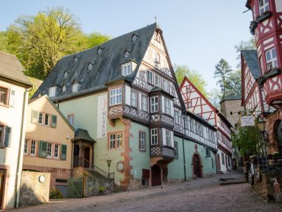
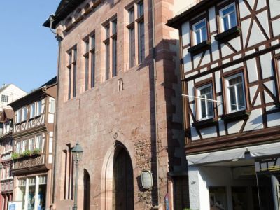
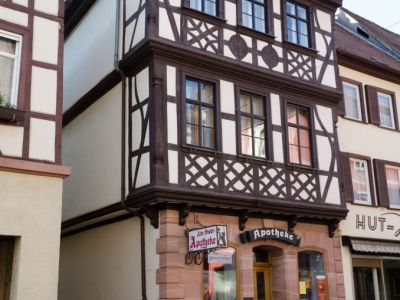
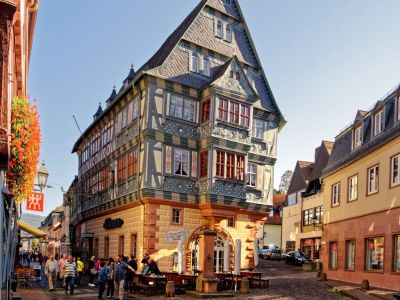
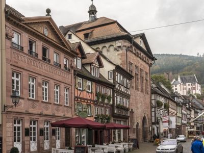
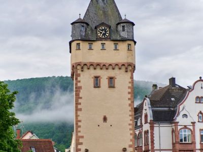
Strolling through Miltenberg’s old town, you’ll be enveloped in a tapestry of half-timbered houses with colorful facades, leaning over narrow lanes. The central square is framed by historic inns and civic buildings. You’ll pass landmarks like the Würzburg Gate, the old city walls, the Gothic St. James’ Church, and experience the charm of this “city of wood” beside the Main River.
In the end, the mosaic beneath your feet is where it all begins. The multicolored cobblestones feel almost like a LEGO set-each piece a fragment of memory. They provide the ingredients for the city's story. Let this self-guided walking tour help unfold that story.
Miltenberg’s name comes from the castle above the town-Mildenburg-from which the settlement below took its name.
Long before the Middle Ages, the area around Miltenberg was already inhabited. Prehistoric ring walls on local hills testify to early settlement. During Roman times, Miltenberg lay near the empire’s outer frontier; its riverside position made it a strategic point. When the Romans withdrew in the 3rd century AD, the region faced incursions by the Alemanni and other tribes, and settlement patterns shifted.
In the early Middle Ages, the area came under Frankish control, and new settlements formed near the old Roman defenses. A Carolingian church may have stood by the 9th century, built using stones from earlier Roman structures. The medieval core of Miltenberg developed around a toll station on the Main River, protected by the castle above. The town benefited from a clever economic policy-a medieval trading privilege requiring passing merchants to display or store their goods locally for a period-which spurred commerce, warehousing, and the growth of inns.
By 1237, Miltenberg was recognized as a town, complete with walls, gates, and towers. It remained under the influence of the Archbishopric of Mainz for many centuries, a connection that shaped much of its political and cultural life. Throughout its history, Miltenberg weathered numerous conflicts: it was affected by the German Peasants’ War in 1525, and parts of the town were burned in 1552. During the Thirty Years’ War in the 17th century, war and plague decimated the population.
In the Napoleonic era, Miltenberg’s status shifted again. Until 1803, it belonged to Electoral Mainz. Over the next decade, it changed hands between duchies before finally joining the Kingdom of Bavaria in 1816.
Strolling through Miltenberg’s old town, you’ll be enveloped in a tapestry of half-timbered houses with colorful facades, leaning over narrow lanes. The central square is framed by historic inns and civic buildings. You’ll pass landmarks like the Würzburg Gate, the old city walls, the Gothic St. James’ Church, and experience the charm of this “city of wood” beside the Main River.
In the end, the mosaic beneath your feet is where it all begins. The multicolored cobblestones feel almost like a LEGO set-each piece a fragment of memory. They provide the ingredients for the city's story. Let this self-guided walking tour help unfold that story.
How it works: Download the app "GPSmyCity: Walks in 1K+ Cities" from Apple App Store or Google Play Store to your mobile phone or tablet. The app turns your mobile device into a personal tour guide and its built-in GPS navigation functions guide you from one tour stop to next. The app works offline, so no data plan is needed when traveling abroad.
Download The GPSmyCity App
Miltenberg Introduction Walking Tour Map
Guide Name: Miltenberg Introduction Walking Tour
Guide Location: Germany » Miltenberg (See other walking tours in Miltenberg)
Guide Type: Self-guided Walking Tour (Sightseeing)
Tour Duration: 1 Hour(s)
Travel Distance: 1.7 Km or 1.1 Miles
Guide Location: Germany » Miltenberg (See other walking tours in Miltenberg)
Guide Type: Self-guided Walking Tour (Sightseeing)
Tour Duration: 1 Hour(s)
Travel Distance: 1.7 Km or 1.1 Miles
Sights Featured in This Walk

The Most Popular Cities
/ view all