

Punta Arenas Introduction Walking Tour (Self Guided), Punta Arenas
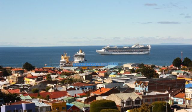
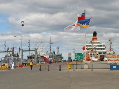
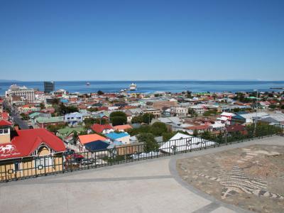
From the dramatic peaks of the Andes Mountains to the penguin-filled shores of Magdalena Island, the landscapes surrounding Punta Arenas are nothing short of extraordinary. Set along the Strait of Magellan in southern Chile, the city is the world’s southernmost urban center of notable size-and long a point of passage for those headed toward Antarctica. Long before shipping routes shifted to the Panama Canal, this location made Punta Arenas a vital stop for vessels navigating between oceans.
The region has been home to indigenous groups for thousands of years, adapting to the Patagonian landscape long before European explorers arrived. The first contact came in the 1500s, when Spanish and Portuguese expeditions began charting the strait. Punta Arenas, meaning "Sandy Point", refers to the sandy, narrow point of land where the city is located on the shores of the Strait of Magellan. Still, it wasn't until 1848 that the Chilean government established a permanent settlement, setting up a penal colony and military post to solidify control over this crucial passage.
What followed was a wave of immigration-families from Croatia, Britain, Germany, and other parts of Europe arrived, leaving their mark on the city’s architecture, economy, and social fabric. By the late 19th century, gold discoveries and the booming sheep ranching industry turned Punta Arenas into one of Chile’s most prosperous cities. Before the Panama Canal opened in 1914, it was among the busiest ports in the Southern Hemisphere.
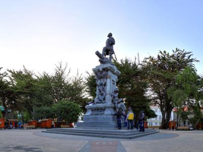
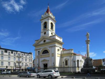
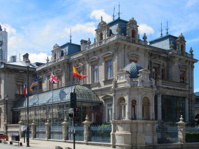
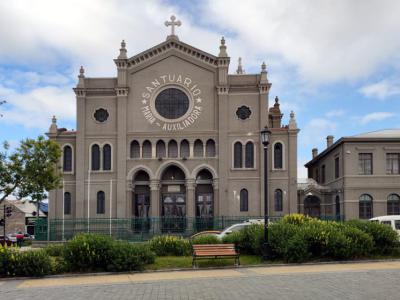
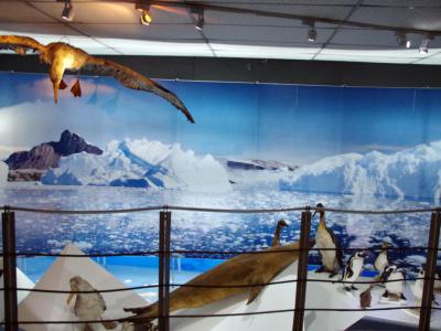
Walking through town today, you’ll find echoes of its past in grand 19th-century mansions, fascinating museums, and carefully preserved public spaces. The Sara Braun Palace and the Maggiorino Borgatello Museum reflect the city’s blend of cultures and frontier ambition. Even the local cemetery, with its elaborate tombs and tree-lined paths, tells a story of the people who shaped the region. Despite its remote setting, Punta Arenas continues to evolve-balancing its indigenous heritage, European influences, and role in polar exploration.
Follow this self-guided tour that takes you through its historic sites, cultural landmarks, viewpoints and promenades. Let the city and its stories unfold one stop at a time.
The region has been home to indigenous groups for thousands of years, adapting to the Patagonian landscape long before European explorers arrived. The first contact came in the 1500s, when Spanish and Portuguese expeditions began charting the strait. Punta Arenas, meaning "Sandy Point", refers to the sandy, narrow point of land where the city is located on the shores of the Strait of Magellan. Still, it wasn't until 1848 that the Chilean government established a permanent settlement, setting up a penal colony and military post to solidify control over this crucial passage.
What followed was a wave of immigration-families from Croatia, Britain, Germany, and other parts of Europe arrived, leaving their mark on the city’s architecture, economy, and social fabric. By the late 19th century, gold discoveries and the booming sheep ranching industry turned Punta Arenas into one of Chile’s most prosperous cities. Before the Panama Canal opened in 1914, it was among the busiest ports in the Southern Hemisphere.
Walking through town today, you’ll find echoes of its past in grand 19th-century mansions, fascinating museums, and carefully preserved public spaces. The Sara Braun Palace and the Maggiorino Borgatello Museum reflect the city’s blend of cultures and frontier ambition. Even the local cemetery, with its elaborate tombs and tree-lined paths, tells a story of the people who shaped the region. Despite its remote setting, Punta Arenas continues to evolve-balancing its indigenous heritage, European influences, and role in polar exploration.
Follow this self-guided tour that takes you through its historic sites, cultural landmarks, viewpoints and promenades. Let the city and its stories unfold one stop at a time.
How it works: Download the app "GPSmyCity: Walks in 1K+ Cities" from Apple App Store or Google Play Store to your mobile phone or tablet. The app turns your mobile device into a personal tour guide and its built-in GPS navigation functions guide you from one tour stop to next. The app works offline, so no data plan is needed when traveling abroad.
Download The GPSmyCity App
Punta Arenas Introduction Walking Tour Map
Guide Name: Punta Arenas Introduction Walking Tour
Guide Location: Chile » Punta Arenas (See other walking tours in Punta Arenas)
Guide Type: Self-guided Walking Tour (Sightseeing)
Tour Duration: 2 Hour(s)
Travel Distance: 4.0 Km or 2.5 Miles
Guide Location: Chile » Punta Arenas (See other walking tours in Punta Arenas)
Guide Type: Self-guided Walking Tour (Sightseeing)
Tour Duration: 2 Hour(s)
Travel Distance: 4.0 Km or 2.5 Miles
Sights Featured in This Walk


The Most Popular Cities
/ view all