

Napier Art Deco Architecture Walk (Self Guided), Napier
Architect Louis Hay was adamant. He believed that Napier’s look should be based on local architects’ ideas. His wish was granted, though probably not in the way he wanted. On the morning of February 3rd, 1931, a massive earthquake-measuring 7.8 on the Richter scale-struck Hawke’s Bay. In just minutes, most of central Napier was flattened, fires swept through the ruins, and over 250 lives were lost. The destruction was immense, but it also opened the way for one of the most ambitious urban rebuilds in New Zealand’s history. Instead of replacing what was lost in the same style, city leaders decided to embrace a new look that spoke of progress and modernity.
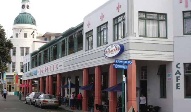
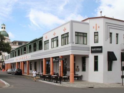
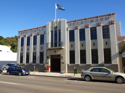
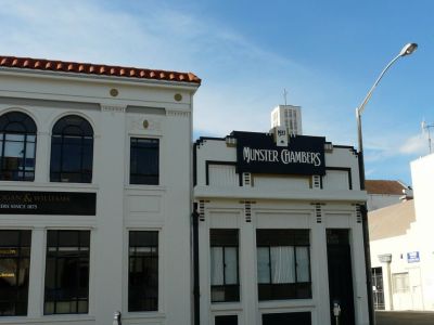
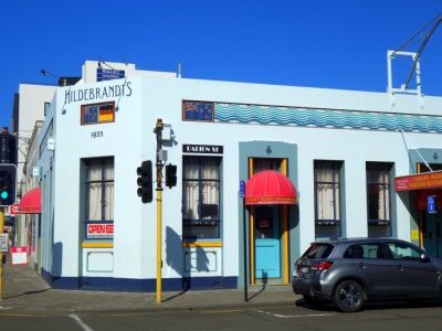
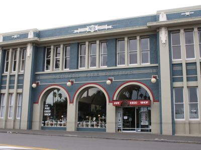
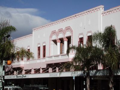
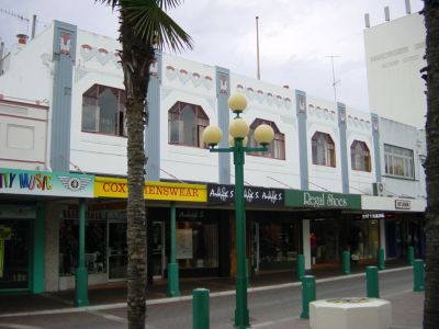
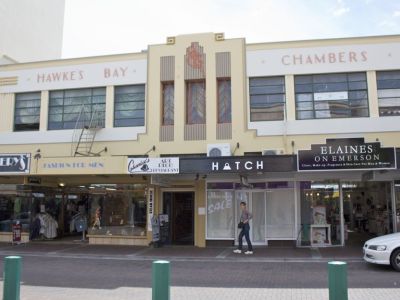
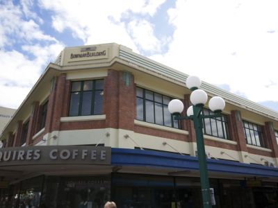
The early 1930s were years when Art Deco, with its streamlined geometry and decorative motifs, was spreading across the world. In Napier, the style became not just fashionable but practical. Reinforced concrete-sturdier against tremors-was matched with zigzags, sunbursts, stylized Māori motifs, and bright color schemes that gave the new streets both strength and personality. Alongside the main Art Deco trend, touches of Spanish Mission and Stripped Classical styles were added, creating a varied but harmonious streetscape that still feels remarkably unified.
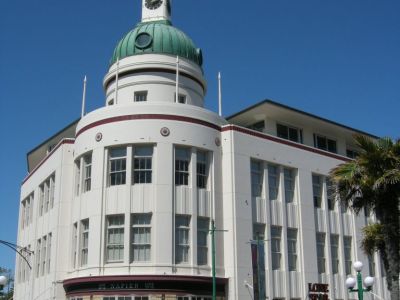
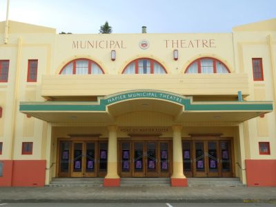
The speed of the rebuild was startling. Within two years, new banks, shops, hotels, and civic buildings lined the streets, and Napier gained a reputation as the “Art Deco City.” Among the landmarks was the Masonic Hotel, reconstructed on Marine Parade in 1932. Its white façade and curved balconies combined Deco with Mediterranean influences, offering both strength and elegance in a single design. Like many of Napier’s buildings, it symbolized resilience-rising directly from the ashes of the earthquake to welcome travelers once more.
As decades passed, tastes shifted and some Deco details were covered or altered, but by the late 20th century locals realized the uniqueness of what the buildings represented. Restoration projects began, and Napier’s 1930s heart was carefully polished rather than replaced. Today, it is regarded as one of the best examples of Art Deco urban design in the world, attracting visitors who come to see a city that rebuilt itself in style.
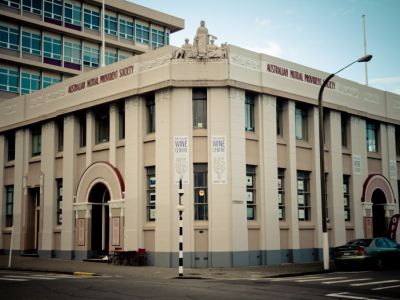
Now, as you walk these streets, look closely at the façades: every zigzag, curve, and sunburst is a reminder of how Napier turned tragedy into triumph. This is not just a city of Art Deco-it’s a city of resilience, imagination, and reinvention, inviting you to step into a story written in stone and sunlight.
The early 1930s were years when Art Deco, with its streamlined geometry and decorative motifs, was spreading across the world. In Napier, the style became not just fashionable but practical. Reinforced concrete-sturdier against tremors-was matched with zigzags, sunbursts, stylized Māori motifs, and bright color schemes that gave the new streets both strength and personality. Alongside the main Art Deco trend, touches of Spanish Mission and Stripped Classical styles were added, creating a varied but harmonious streetscape that still feels remarkably unified.
The speed of the rebuild was startling. Within two years, new banks, shops, hotels, and civic buildings lined the streets, and Napier gained a reputation as the “Art Deco City.” Among the landmarks was the Masonic Hotel, reconstructed on Marine Parade in 1932. Its white façade and curved balconies combined Deco with Mediterranean influences, offering both strength and elegance in a single design. Like many of Napier’s buildings, it symbolized resilience-rising directly from the ashes of the earthquake to welcome travelers once more.
As decades passed, tastes shifted and some Deco details were covered or altered, but by the late 20th century locals realized the uniqueness of what the buildings represented. Restoration projects began, and Napier’s 1930s heart was carefully polished rather than replaced. Today, it is regarded as one of the best examples of Art Deco urban design in the world, attracting visitors who come to see a city that rebuilt itself in style.
Now, as you walk these streets, look closely at the façades: every zigzag, curve, and sunburst is a reminder of how Napier turned tragedy into triumph. This is not just a city of Art Deco-it’s a city of resilience, imagination, and reinvention, inviting you to step into a story written in stone and sunlight.
How it works: Download the app "GPSmyCity: Walks in 1K+ Cities" from Apple App Store or Google Play Store to your mobile phone or tablet. The app turns your mobile device into a personal tour guide and its built-in GPS navigation functions guide you from one tour stop to next. The app works offline, so no data plan is needed when traveling abroad.
Download The GPSmyCity App
Napier Art Deco Architecture Walk Map
Guide Name: Napier Art Deco Architecture Walk
Guide Location: New Zealand » Napier (See other walking tours in Napier)
Guide Type: Self-guided Walking Tour (Sightseeing)
Tour Duration: 2 Hour(s)
Travel Distance: 1.1 Km or 0.7 Miles
Guide Location: New Zealand » Napier (See other walking tours in Napier)
Guide Type: Self-guided Walking Tour (Sightseeing)
Tour Duration: 2 Hour(s)
Travel Distance: 1.1 Km or 0.7 Miles
Sights Featured in This Walk


Walking Tours in Napier, New Zealand

Create Your Own Walk in Napier
Creating your own self-guided walk in Napier is easy and fun. Choose the city attractions that you want to see and a walk route map will be created just for you. You can even set your hotel as the start point of the walk.
Napier Introduction Walking Tour
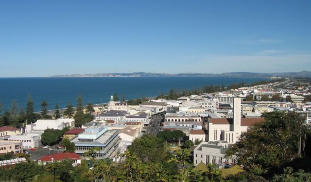
Napier sits on the eastern edge of New Zealand’s North Island, where the Pacific rolls in and the streets look like they gracefully ride the waves. Long before colonial maps, this was Ahuriri to the Māori, the island’s first inhabitants. In the 1800s it took the name Napier, after British soldier Sir Charles Napier, and grew into a thriving port and farming hub. Victorian and Edwardian... view more
Tour Duration: 2 Hour(s)
Travel Distance: 3.0 Km or 1.9 Miles
Tour Duration: 2 Hour(s)
Travel Distance: 3.0 Km or 1.9 Miles
The Most Popular Cities
/ view all